Adelaide mops up after storm deluge
The Adelaide CBD received more rain overnight than its average for the whole of November in a thunderstorm that left more than 10,000 properties without power and roads inundated. See the pictures

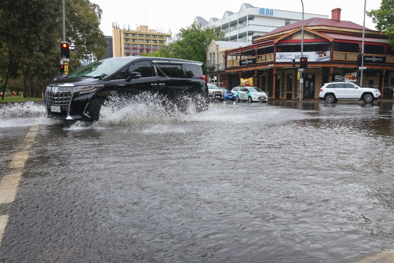
Cars driving through the South Terrace/Pulteney Street intersection this morning. Photo: Tony Lewis/InDaily
The State Emergency Service (SES) has responded to more than 250 jobs this morning, many of them around the Unley Council area, with trees down and flooding near the old Le Cornu site in Forestville.
There are also clusters of flooding callouts around Millswood, Wayville, Torrens Park and Lower Mitcham.
The thunderstorm which hit Adelaide overnight dropped 45.8mm of rain on Scotch College in just one hour (6.02am to 7.02am), according to the Bureau of Meteorology.
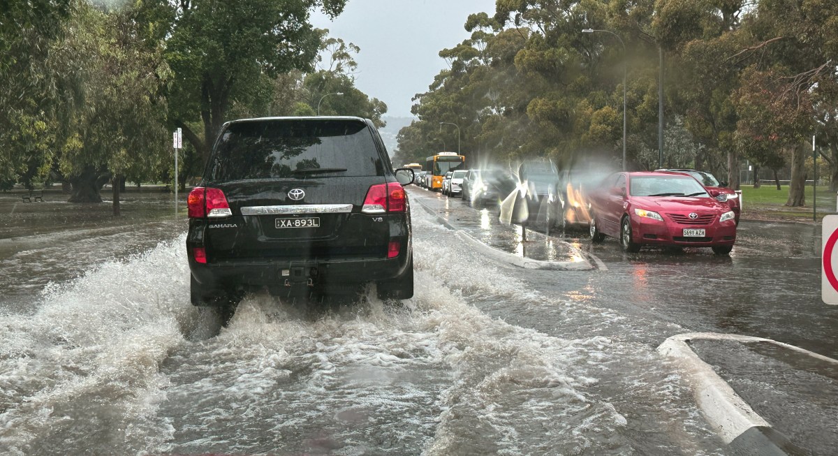
Fullarton Rd flooded outside the Arkaba this morning. Photo: Tony Lewis/InDaily
Adelaide’s West Terrace weather station recorded 31.6mm of rain between 9am Monday and 9am Tuesday, most of it in a few hours this morning.
That’s more than the West Terrace weather station’s average November rainfall of 30.9mm.
Bureau of Meteorology senior meteorologist Simon Timcke said most metropolitan Adelaide areas received between 25 and 40mm.
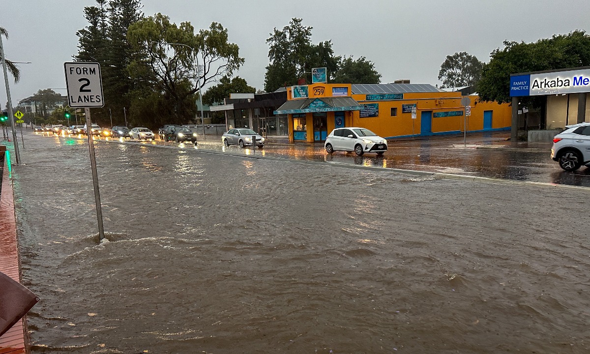
Flooding on Fullarton Rd near the Arkaba Hotel this morning. Photo: Tony Lewis/InDaily
“For Adelaide, we obviously had a lot of fairly intense rainfall earlier this morning,” he said.
“Most of the thunderstorms have moved away to the east and the south now, but still not impossible that we couldn’t see one or two storms through the rest of the afternoon
“But not with the frequency that we saw overnight.”
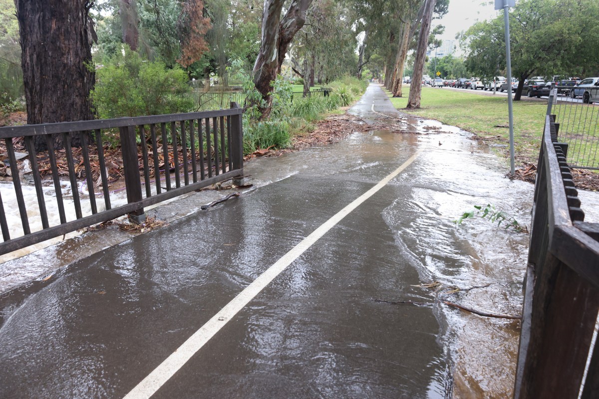
A flooding creek spills over in the south park lands. Photo: Tony Lewis/InDaily
Timcke said the rainfall brought flash flooding to different parts of the metropolitan region, along with some hail.
By 9.15am, more than 10,000 properties were left without power, but at midday SA Power Networks said the number was just above 5000.
Belair (St Johns) received 44.2mm of rainfall in the three hours to 8.51am, while Bellevue Heights received 46.6mm in roughly the same time period.
The storm swept through from the north to the south of Adelaide, with Kapunda receiving 43.8mm between 5.01am to 8.01am) while Noarlunga copped 44.66mm.
Mount Crawford and Mount Lofty both recorded 34mm and 32.6mm respectively.
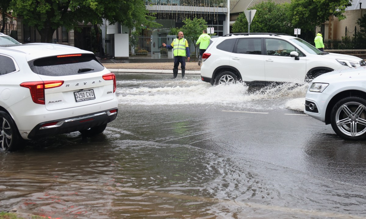
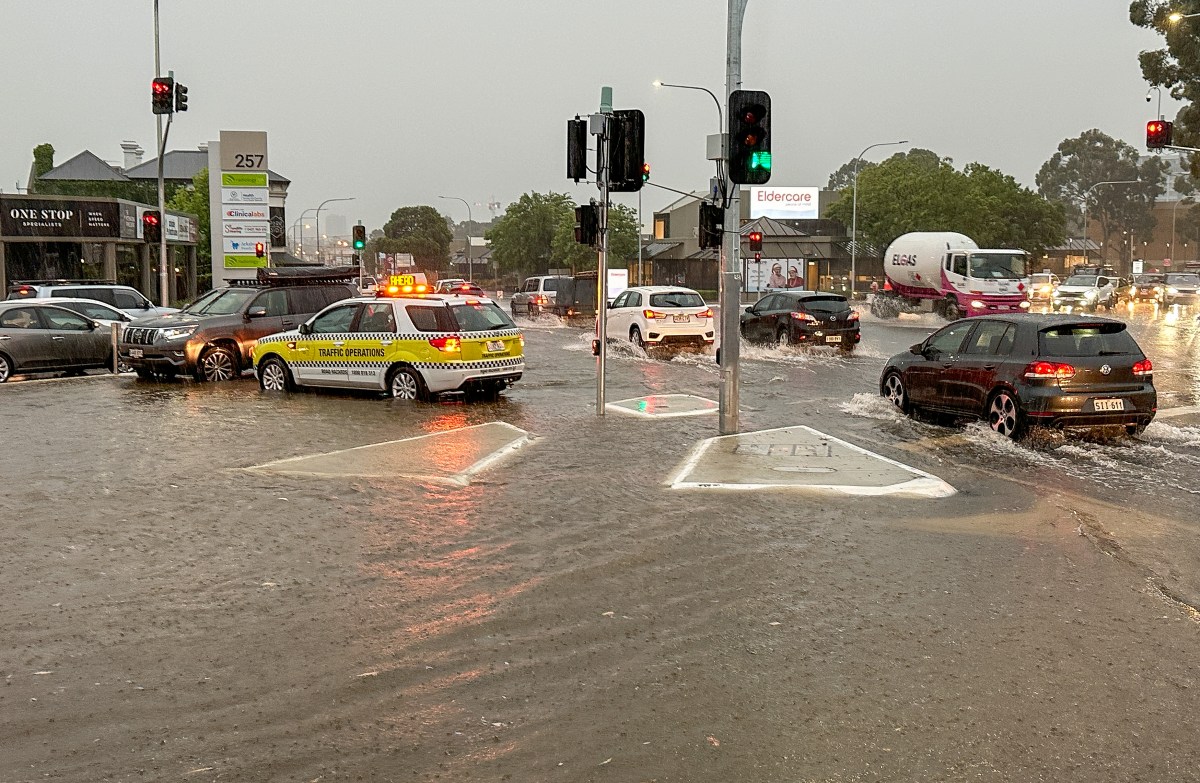
Emergency workers directing traffic in the southern CBD. Photo: Tony Lewis/InDaily
A severe thunderstorm warning remains in place for the Adelaide Metropolitan, Mount Lofty Ranges, Riverland, Murraylands and parts of Mid North, Upper South East and North East Pastoral districts.
A heavy rainfall warning was also in place for people in the Barossa, Mount Barker and Western Alexandrina council areas, but was cancelled this afternoon.
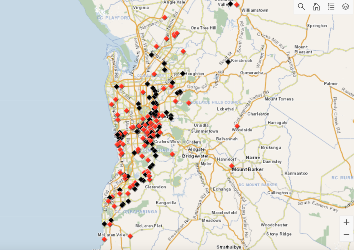
A map of SES jobs across metropolitan Adelaide this morning. Image: SES
The storm left Fullarton Rd outside the Arkaba Hotel under water, blocking the southbound lane. There were reports of household bins floating down Cross Rd.
Glen Osmond Rd and the southern park lands were heavily inundated, along with Anzac Highway outside the Ashford Hospital.
Inundated roads slowed traffic. Photo: Tony Lewis/InDaily
One driver wedged a front wheel into a hole after rushing water dislodged a heavy steel lid on King William Rd.
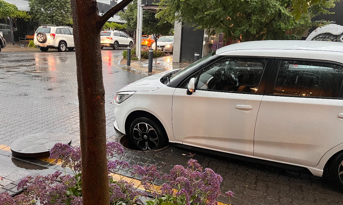
A car stuck in a manhole on King William Road. Photo: Belinda Willis/InDaily
Flights were grounded at Adelaide Airport this morning due to lightning.
The airport said shortly before 9am that flights had resumed and warned passengers there could be delays throughout the day.
“It will take a little bit of time to catch back up today,” Adelaide Airport executive general manager Dermot O’Neill told ABC Radio Adelaide.
“It probably is some good advice for anyone flying today is to touch base with your airline.
“Days like today you can see some of these delays roll through the day, depending on the network plan for the aircraft that particular day.”
Timcke said the “really intense storms” had moved east now, and conditions are expected to improve across Adelaide for the rest of the week.
“We do have pretty much dry conditions for Adelaide for the rest of the week,” he said.
“The outlook for the next five or six days is drier conditions with temperatures increasing by the end of the week.”
– with AAP