Rare map reveals the SA town that never was
Amid debate over a 2500 home subdivision announced this week for south of Adelaide, a map meticulously restored by the state’s last bookbinder has emerged to tell the historic story of a grand plan for the north – the never-built Town of Port Gawler.

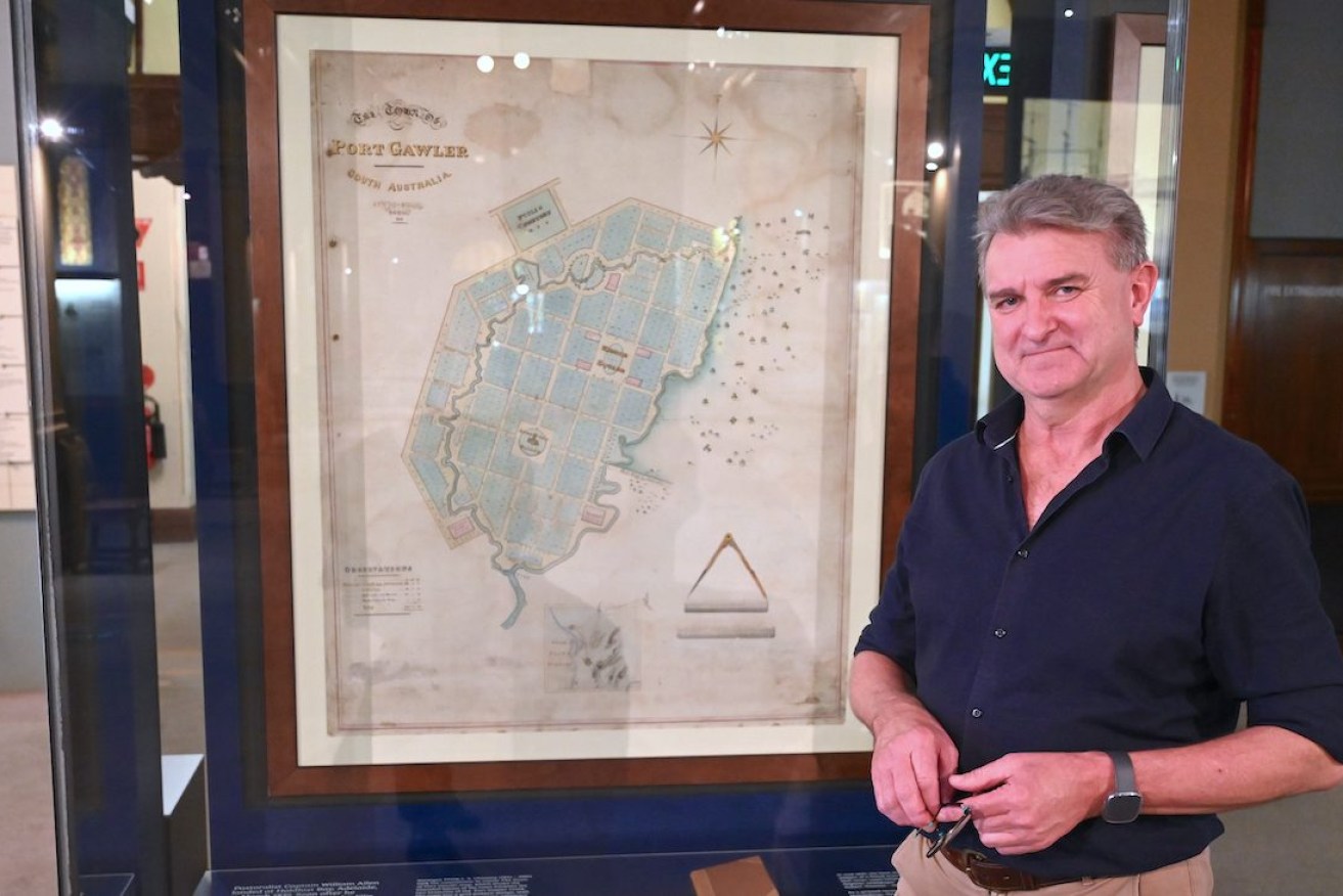
State Library of South Australia senior conservator Peter Zajicek has meticulously restored the map of an SA town never built. Photo: Belinda Willis
The original map bought by the Friends of the State Library at auction last year is on display for the first time, revealing intriguing details about a real estate venture hatched in the 1830s.
Its story begins in Hobart, where legal clerk George Milner Stephen intercepted a letter sent to his brother Alfred detailing how Governor Hindmarsh was asking him to fill the post of South Australia’s Advocate General.
George Stephen instead decided to take his brother’s place, and after arriving in his new home of South Australia, bought 1,600 hectares of swampland 43 kilometres north of Adelaide.
According to a new display at the State Library of South Australia, Stephen then devised an ambitious land scheme, naming his land holdings Port Gawler after Governor Hindmarsh’s replacement George Gawler, and selling a new housing dream.
One half of the land sold quickly and Stephen was boasting of a huge profit.
But the entrepreneur just as quickly came unstuck, facing public accusations of fraudulent property speculation, libel claims and counter-claims that saw his reputation permanently tarnished after he lost a final court case.
In the glass display case at the library’s Mortlock Wing is the original printed 1840 version of legal events, outlined in a bound book also purchased last year and entitled “The Case of the Honourable Mr George Stephen”.
The map’s central role in the story began in 1839, when two men left owning a large portion of the swamp land, Captain William Allen and Captain John Ellis, commissioned grand plans to make a profit from turning their real estate into the new Town of Port Gawler.
“The Town of Port Gawler map, which has been carefully restored by the library’s conservation staff, depicts neat parcels of land, a town square, market and cemetery, laid out near the Port Gawler River. But the map was never published and the town was never built,” library director Geoff Strempel said.
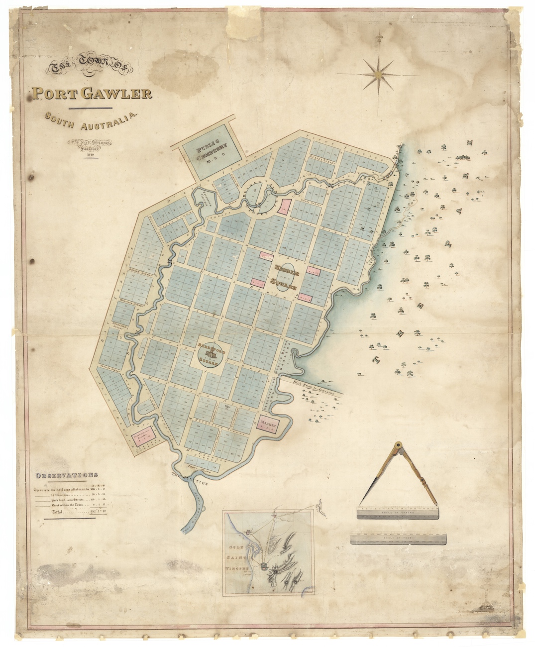
A carefully restored map of the never-built Town of Port Gawler. Photo: State Library of South Australia
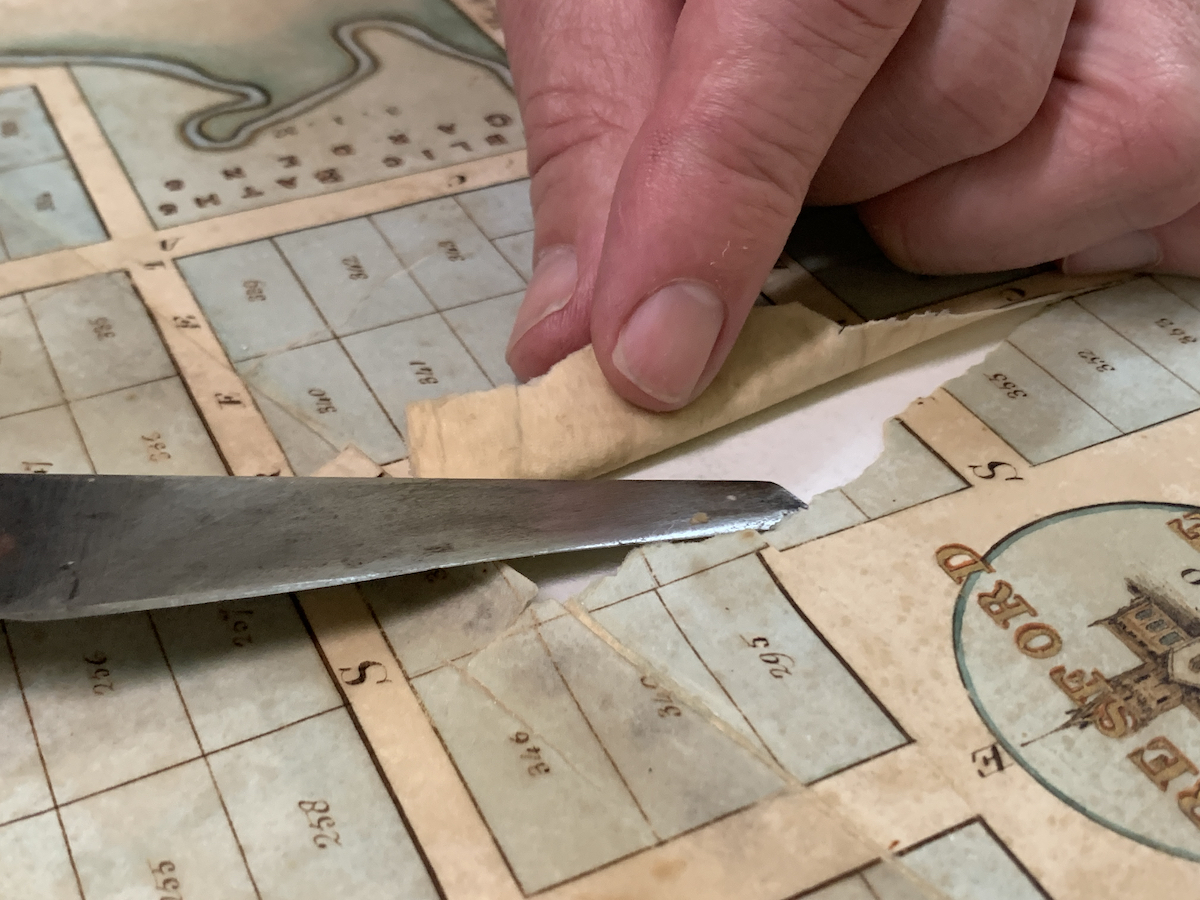
Last year when the map arrived at the library, senior conservator Peter Zajicek said the fragile artefact was ripped, buckled and stained, adding that “none of these items go through life unscathed”.
His job was to restore the map “to look after a part of our history that is going to supersede us”.
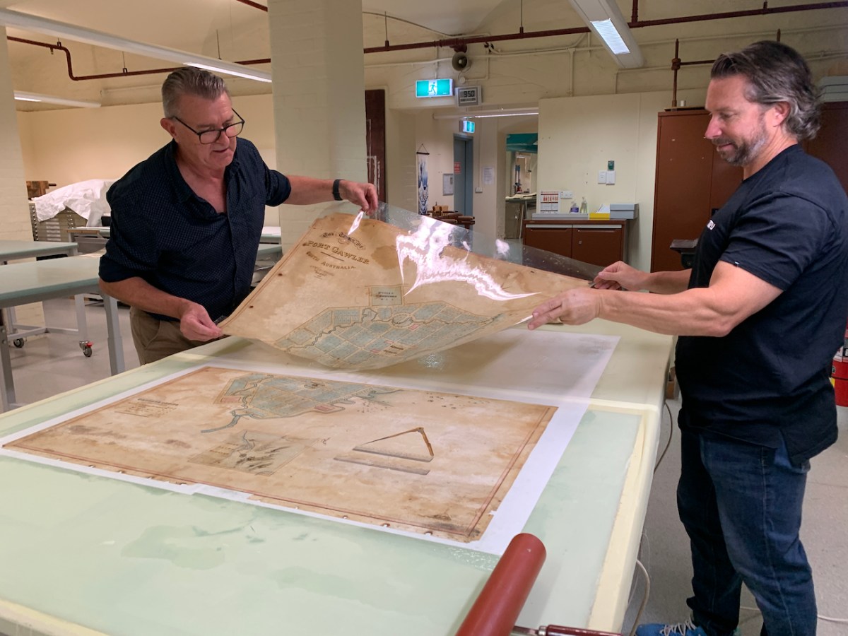
The restoration process began with the artefact being dipped in a deionised water bath for cleaning and to help with the removal of its existing backing. Then, still wet, the map was fixed to a carefully prepared new backing of Japanese tissue paper.
Zajicek is an expert in protecting paper artefacts, starting as an apprentice bookbinder at the State Library at just 16 years of age, joining a team of 50 staff intent on protecting books for the future.
“In my early days it was all about ‘ruggadising’ books so they could be handled, it was designed to make them more robust,” he says from the display’s home at the heritage Mortlock Wing on North Terrace 46 years later.
“(Now) I’m the last bookbinder in the state.”
He describes the careful process of restoring the map, beginning with removing it from a frame and choosing Japanese tissue rather than any other as it is “thinner but stronger with longer fibres” that create greater malleability for when the map is attached.
When the two pieces are joined, each needs to contain equal parts of moisture so they can dry together, Zajicek says, preventing the map from being stretched or stressed by either one shrinking further or faster than the other.
Rips were carefully pressed together, paper smoothed and dried before the hand-coloured map was captured in a high-resolution image so a copy could be made.
Zajicek said the map is still fragile and the original can only be displayed for a few months at a time before returning to storage to prevent light and movement damage.
However, the new copy can take its place in the cabinet to continue telling the story of its creation and the story of its restoration.
Zajicek has learned much about the map’s history during the restoration process, telling how there were plans to run a boat between the new Port Gawler town and Port Adelaide.
It was surveyor Phillip L. S. Chauncy who was responsible for its design with streets named after mariners, explorers and British royalty.
The map – described as “one of the most significant and unique gifts made by the Friends in their endeavours to support and promote State Library collections” – is now on public display for the first time coinciding with the 2023 History Festival until May 31.
“Environmental factors such as light, framing and previous storage arrangements can all affect the condition of important paper artefacts, and if left untreated they can further decay, destroying the item and its history,” Zajicek said.
“The hand-coloured, gilded map is now ready to continue its journey through history.”