Levee failure risk amid thunderstorm warning
A severe thunderstorm and flash flooding warning has been issued for the Riverland, while a failing flood levee near Murray Bridge has prompted a safety alert.

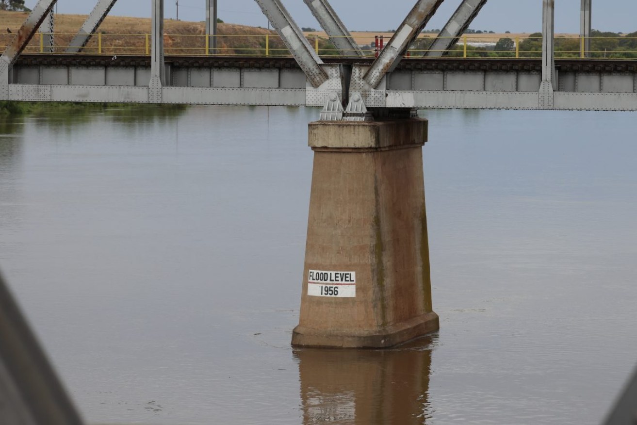
The rising river at Murray Bridge. Photo: Tony Lewis/InDaily
As floodwaters continue to surge down the swollen River Murray, the Bureau of Meteorology today issued a severe weather warning for “damaging winds, large hailstones and heavy rainfall” in the Riverland and Murraylands.
The warning also applies to people in the Flinders, Mid North, Mount Lofty Ranges, Eastern Eyre Peninsula, Yorke Peninsula, North East Pastoral and North West Pastoral districts.
“An amplifying upper trough will combine with a surface trough and an unstable airmass to trigger potentially severe thunderstorms today,” the BoM said this afternoon.
“Severe thunderstorms are likely to produce damaging winds, large hailstones and heavy rainfall that may lead to flash flooding in the warning area over the next several hours.”
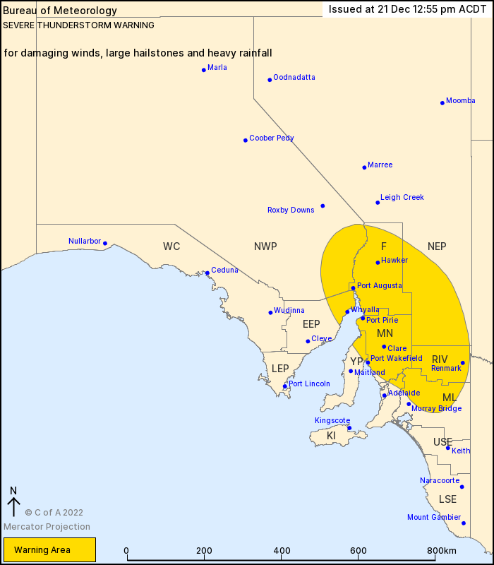
The severe weather warning area outlined by the Bureau of Metrology this afternoon.
The BoM said the severe weather could impact Renmark, Port Augusta, Port Pirie, Clare, Jamestown and Whyalla.
It comes as the State Emergency Service issued a separate warning about a levee failure in Toora, a small locality around 3km north of Murray Bridge.
“The Toora levee is failing and there is a risk of flood waters threatening the safety of people in the area,” the SES said.
“There is a high risk of flooding for low lying areas of Toora Road, due to River Murray level rises.
“There is a chance you may become flooded or isolated if you are in low lying areas of Toora.”
The Toora levee failure is the latest in a series of levee failures along the River Murray. SES chief officer Chris Beattie on Monday said eight levees had suffered “catastrophic” failures while a further 53 had “serious defects”.
Flood watch and act messages apply to every River Murray community in South Australia due to the rising water levels, which are expected to peak in the Riverland later this month.
⚠️ A Severe Thunderstorm Warning has been issued for central and eastern parts of the State. Damaging winds, heavy rainfall and large hail are possible. Keep up to date with the latest warnings at: https://t.co/4LRmonZwrT pic.twitter.com/dNx98GfukC
— Bureau of Meteorology, South Australia (@BOM_SA) December 21, 2022
Peak flows are expected at up to 220GL across the border into Renmark at Christmas time with the peak high-water level working its way downstream.
Beattie today said that communities along the River Murray “should prepare for further flooding in low lying areas”.
“Those in flood risk areas should prepare their property for flooding and secure their valuables,” he said in a statement.
“I would like to reassure everyone that we are not going to see a sudden jump in water levels, but it is certainly going to rise to reach the predicted peak.”
The state government yesterday banned boats, jetskis, canoes, swimming, fishing and yabbying in the River Murray, with offenders facing fines of up to $10,000.
Premier Peter Malinauskas said boats and activity on the river’s edges could damage levee banks or divert the resources of emergency services away from other tasks if boaters or swimmers got into trouble.
About 4000 properties across the length of the Murray in SA are expected to be inundated by the end of the flooding event.
The high-water mark is likely to hit Renmark around Boxing Day before reaching Murray Bridge by January 17.