River Murray flow raised again with risk of biggest flood since 1956
River Murray flow forecasts have jumped yet again to a new estimate of 165GL of water a day surging across the border in December – and a warning that it could pass 200GL and inundate more than 4000 properties with the biggest flood since 1956.

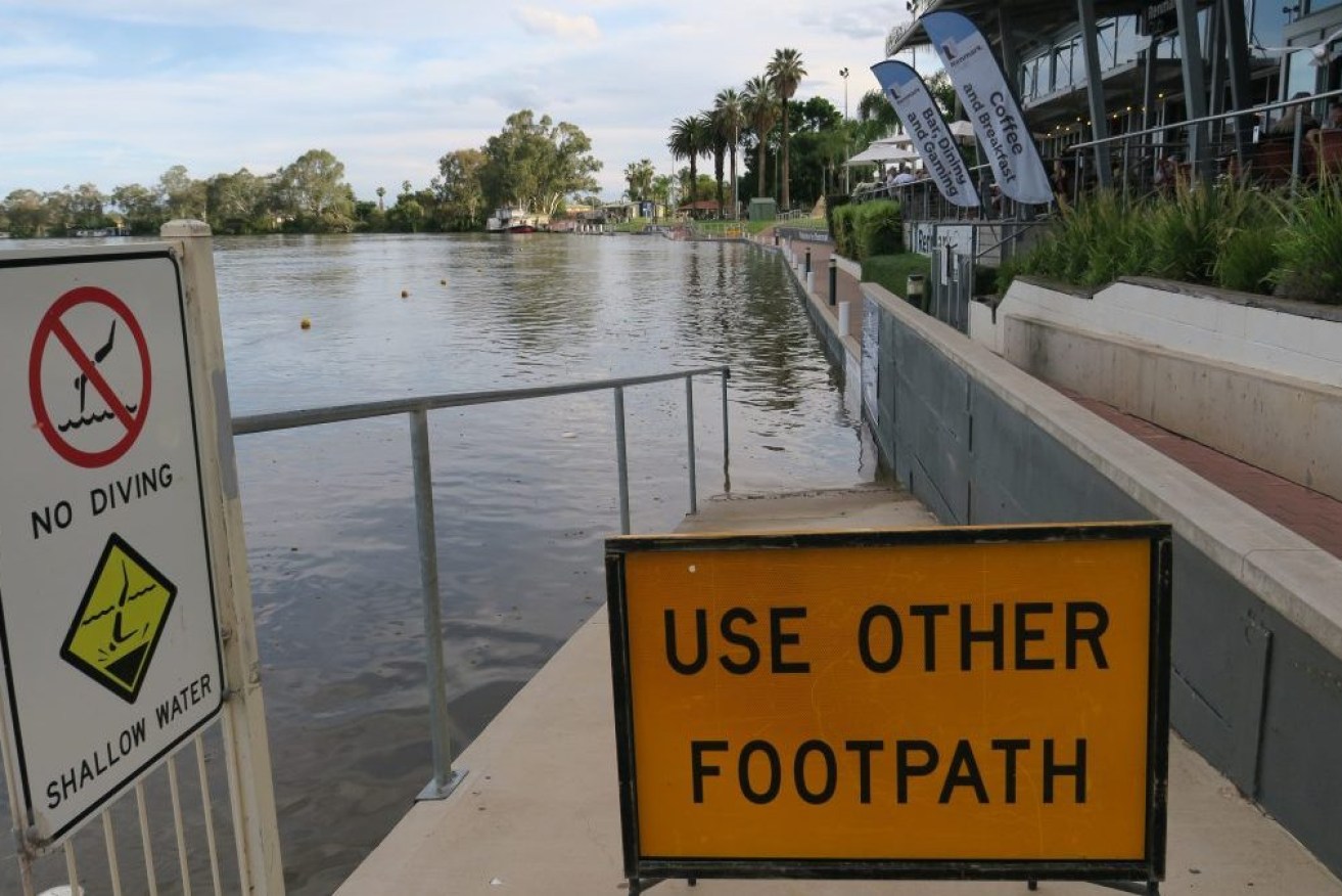
Rising River Murray water covers the footpath in front of the Renmark riverfront club. Photo: Jason Katsaras/InDaily
As residents work to shore up their properties, SA Health is working on plans to move vulnerable patients from Renmark Hospital and aged care facilities to safer Riverland locations if water levels threaten a nearby reconstructed levee bank.
State Government ministers and the State Emergency Service today announced the revised 165GL flow estimate – up from 150GL just two days ago – saying there is a “moderate probability” of 200GL a day and “lesser probability” of 220GL a day in December.
State Emergency Service chief officer Chris Beattie said high rainfall of between 25 and 100 millimetres forecast for large areas of the Murray-Darling Basin between November 10 and November 17 could impact today’s forecast.
Peak flows are still expected in early December but towns like Renmark could see 150GL a day by late November.
Beattie said the Waikerie ferry will be moved at 100GL, Lyrup and Morgan ferries closed at 120GL and Penong, Walkers Flat and Swan Reach between 120GL to 130GL.
Estimates of 160GL a day flow would flood more than 360 properties along the river, Beattie said, rapidly increasing to about 4250 with flows higher than 200GL and at 220GL, “well over 5000 properties”.
“We are working hard with communities across the River Murray area, we’ve based a team out of Loxton and have a number of contingency plans for those communities,” he said.
The flow across the border in 1974 was recorded at 180GL a day and the largest River Murray flood on record in 1956 peaked at 341GL a day.
“These new flow predictions raise the risk of flooding in low lying areas and we are urging people to prepare as best they can,” Environment and Water Minister Susan Close said.
“The uncertainties in flow forecasting mean people need to prepare for at least the worst-case scenario so we get through this event without any risk to life and reduce impact on property.”
Close said another emerging problem for communities reported by the Central Irrigation Trust was pumps being flooded to fruit properties relying on River Murray water irrigation in hotter months.
“When water is over 180GL they might not be able to pump,” she said.
“This could lead to a flood at lower levels and a drought at higher levels.”
In response to constant revising of forecasts, Close said it was “exceptionally difficult” as the main flood peak is currently moving through the broad and complex floodplain between the River Murray and the Edward and Wakool River system.
“Each time we are able to give an update we are,” she said, adding that “the more rain in Victoria the more flow through to South Australia”.
At this stage, the Lower Lakes are not currently forecast to experience flood levels, with the government expecting to manage the peak barrage releases but levels can be easily whipped up from high winds.
The SES held a community meeting in Mannum last night with more planned for Waikerie and Murray Bridge next week.
Mid Murray Council chief executive officer Ben Scales told the meeting in Mannum that about 250km of his region’s 3000km road network would likely be affected and some properties would be inundated with water.
Scales said seven more sand bag locations would be open locally over the weekend, with 68 truckloads of sand already delivered to the Mid Murray region.
The region also announced a list of camping and storage facilities available for residents having to leave their homes.
Emergency Services Minister Joe Szakacs urged those living along the River Murray to continually monitor the SASES website “and to continue preparing themselves and their properties for what is expected to come down the river in the coming weeks”.
“This will give residents the best possible chance of getting through these challenging times without injury or property loss,” he said.
“It’s important that river communities remain vigilant and continue to prepare, particularly those with low lying shacks.”