Rising River Murray puts dairy farmers on levee alert
Dairy farmers are closely monitoring levees protecting their pastures, cows, dairies and houses in the lower reaches of the River Murray as towns from Renmark to Lake Alexandrina and Lake Albert band together to fend off rising water flows.

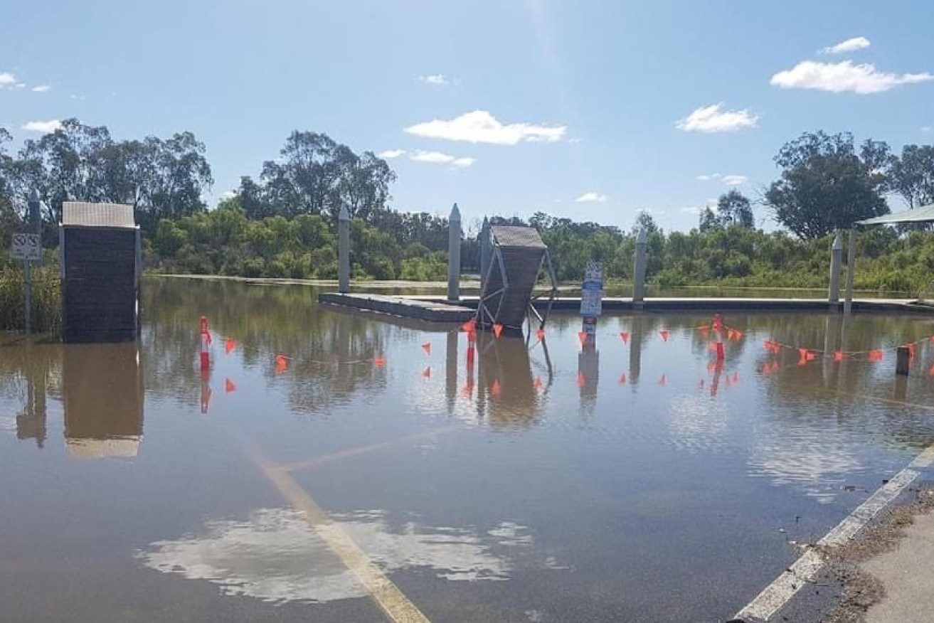
River Murray water covers a boat ramp at Cobdogla in the Riverland. Photo: Berri Barmera Council
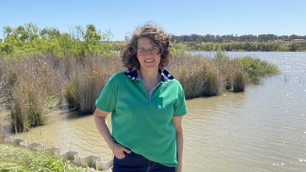
At Jervois near Tailem Bend, dairy farmer and newly minted Murray Darling Basin engagement officer Kate Bartlett is receiving several phone calls a day from locals worried about river heights and whether levees will hold back the rising water.
Dairy farms built on reclaimed floodplains stretching from Mannum and downstream to the lower lakes and Coorong are protected by 110kms of levees. The levees were built decades ago and are “generally designed for flows equivalent to those experienced in 1974 at 183GL flow at the SA border”, according to the Environment and Water Department.
But Bartlett said much of the land protected by levees is below the river line and relies on 67km of government-owned levees and another 43km of privately owned levees being adequately maintained. There are concerns about the River Murray, expected to peak at 135GL a day during November, breaching levee banks.
Already, farmers are dealing with high rainfall and leaching water in pastures alongside the riverbank causing problems with cows getting sore feet and mastitis infections.
“We farm right behind a levee bank and the swamps as we call them are loving the rain, but they are wet,” said Bartlett, who milks about 240 cows every day of the year with her husband Kym and son.
“(The cows’) feet are sore they are standing in wet, they are lying in wet.”
Bartlett said sandbags were being installed below Murray Bridge but a breach or leaching water could destroy pumps used to directly service homes and dairies along the Murray.
It could also threaten some homes and pastures, creating challenges moving cows to higher ground.
Most recent forecasts are that flows to SA will reach about 100 GL a day around 12 November and about 135GL a day in early December, the highest flow since the early to mid-1970s, which peaked at 183GL a day in 1974.
River Murray dairy farmer and Murray Darling Basin Authority rep Kate Bartlett. Photo: MDBA
South Australian Dairyfarmers Association chief executive officer Andrew Curtis said a large number of the state’s 180 dairy farmers relied on River Murray water downstream from Lock One at Blanchetown. The 2200 kilometre long river ends at the lakes and Murray Mouth at Goolwa.
“From a planning point of view some of our members are really the canary in the coal mine if there’s something wrong with low river levels, they are the first that can’t irrigate,” he said.
“In terms of high flows at the moment we are in a watch and be alert stage.”
Dairy farmers are in regular contact with the Environment and Water Department in terms of surveying the levees and making sure they are in adequate shape.
“The levees are probably good to 140 to 150GL, if it gets higher than that we start to worry,” Curtis said.
A Department of Environment and Water spokesman said government-owned levees were generally in good condition and inspected every four months by engineers but privately owned levees in the Lower Murray region between Mannum and Wellington were not inspected by the department.
Additional “topping of the levees is occurring where possible to ensure crest heights are maintained to design level,” he said.
Minor repair works were also underway on the government owned levee banks and were expected to be finished during November.
“These have been planned for several months but limited by weather. DEW continues to assist the government with emergency repair of existing town levees as has been occurring in the Riverland,” he said.
State-owned river vessel waste disposal stations in this section of the River Murray were also likely to be decommissioned in coming weeks to protect “the assets as well as public safety and water quality”.
An update on river flows and levees is expected to be announced by Environment and Water Minister Susan Close and State Emergency Services chief officer Chris Beattie later today.
The SES is holding a series of community meetings in the Riverland this week to update river town communities on flows. One was held in Renmark on Wednesday night and with others to be held in Berri and Cobdogla this afternoon and evening.
Berri
When: Thursday 3rd, November, 6:30-8pm
Where: Berri Town Hall, 19 Wilson Street, Berri
Cobdogla
When: Thursday, 3 November, 3pm to 4:30pm
Where: Cobdogla Primary School Gym, Dolan Street, Cobdogla
More community meetings are planned for Mannum next Wednesday, Blanchetown on Thursday and also in Waikerie and Murray Bridge in the coming weeks.