Flooding plains as River Murray hits six-year flow peak
River Murray flows into South Australia are exceeding 50,000 megalitres a day for the first time since December 2016, with its high waters bringing new life to long dry wetlands and floodplains.

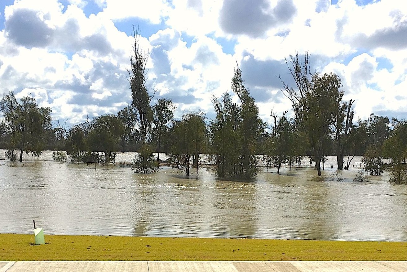
Snake Island and its bridge on the River Murray at Loxton is completely under water. Pic: Beth Huppatz
While locals are welcoming the water as it delivers a “well-deserved drink” to important environmental flood plains, it has also led to the closure of numerous camp grounds and the Renmark houseboat wharf.
Environment and Water Department delivery manager Chrissie Bloss said water storages throughout the Murray Darling Basin system were mainly full after high rainfall in Queensland, New South Wales and Victoria gradually worked its way through the river network.
“We are seeing floodplains that haven’t had a drink in six years being inundated with water,” Bloss said.
“Red gum in particular need inundation to be able to reproduce, it has a large impact on birds and fish.
“The river looks beautiful.”
Locals are out in boats exploring creeks and backwaters and they expect an explosion in bird and plant life during the next few months.
As water levels rise, department manager of environmental water Tony Herbert said about 3900 hectare of River red gums are being inundated with vital water that will spur leaf, flower and seed production.
“The River red gums typically need water every one to four years on average to maintain condition so it’s important for the local ecosystem to have water reaching the trees,” Herbert said.
Black box trees are also benefiting from far higher flows as levels rise right along the River Murray’s banks, while water is flowing into the wetlands at Martins Bend, Wigley Reach and Hogwash Bend.
“These are areas that have only received water in the last six years via pumping,” Herbert said.
At Loxton in the Riverland, Snake Island and its bridge near the town centre river bank is completely submerged while water is filling flood plains at Katarapko near Loxton, Chowilla near Renmark and Pike River anabranches.

Water laps trees in Sawmill just off the River Murray channel. Photo: Dept for Environment and Water
Chowilla has the largest remaining natural river red gum forest in the Lower Murray and is part of the Riverland Ramsar wetland of natural importance supporting migratory birds and other species.
It is home to iconic and endangered species like the regent parrot, Murray cod and southern bell frog.
Across the state there are 500 hectares of black box trees receiving water, 300 hectares more than last year, along with 1500 hectares of lignum, over 1000 hectares more than last year, inundated with water from higher flows.
Renmark Paringa Mayor Neil Martinson said the Riverland was looking good and the council was managing impacts of rising waters on bank footpaths and infrastructure.
But he warned those out on boats or fishing to be careful with faster, higher flows.
Kelsey Hogan from the Barmera Visitor Information Centre said nearby Lake Bonney and the River Murray were looking good and well worth a visit from tourists.