More damaging winds forecast for SA
A strong cold front is likely to continue to wreak havoc on South Australia today, with a severe weather warning in place for damaging winds.

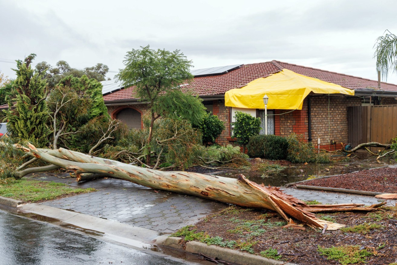
Damage to a house on Earl Avenue in Salisbury. Photo: Tony Lewis/InDaily
The Bureau of Meteorology issued the warning across the southeast of the state, including parts of metropolitan Adelaide, Mount Lofty Ranges, Kangaroo Island, Lower South East, Yorke Peninsula, Mid North, Murraylands and Upper South East districts.
It forecast damaging gusts in excess of 90km/h are likely, with winds expected to ease this evening.
The SES has advised people to move cars under cover or away from trees, secure loose items and stay indoors, away from windows, while conditions are severe.
Adelaide is forecast to reach 14C today with southwesterly winds of between 35 to 50km/h.
There is a very high chance of showers, becoming less likely in the evening.
It comes after a small, brief tornado hit the Salisbury area in Adelaide’s north and dumped up to 60mm of rain on Monday, prompting the SES to respond to more than 400 incidents.
[solstice_jwplayer mediaid=”CJhBGVVA” title=”Mini tornado hits northern suburbs” sponsoroption=”352624″ /]
The mini-tornado struck shortly after 5am, bringing down powerlines, trees and damaging houses.
Nine unexpected power outages were also reported across metropolitan and regional SA on Monday.
The Bureau of Meteorology said the Mount Lofty, Parafield and Edinburgh Air Force weather stations broke their daily May rainfall records.
Other parts of the state recorded wind gusts in excess of 90km/h.