Spring storms hit state
Adelaide’s erratic spring weather is set to reach a crescendo today as a combination of heat, storms, wind and rain spark a multitude of Bureau of Meteorology warnings across the state.
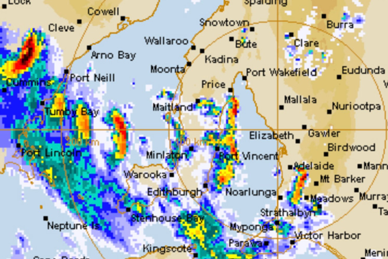
Bureau of Meteorology radar at 7am.
Thunderstorms are predicted for several areas and a fire weather warning has been issued for the North West Pastoral, Eastern Eyre Peninsula and Flinders districts.
It follows a scrub and grass fire at Carriewerloo Homestead 35km north of Iron Knob in the states Far North yesterday afternoon.
About CFS firefighters, five appliances and a bulk water carrier battled the fire that is believed to have been caused by lightning.
BOM has also issued a severe thunderstorm warning for the Adelaide Metropolitan area, Mount Lofty Ranges, Lower Eyre Peninsula, Yorke Peninsula, Kangaroo Island and parts of the West Coast, Eastern Eyre Peninsula, Flinders, Mid North, Murraylands and the Upper South East.
Adelaide is expecting a maximum temperature of 29C with an 80 per cent chance of 2mm-8mm of rain.
Gusty winds will accompany the storm front with winds east to southeasterly 20 to 30 km/h tending east to northeasterly 25 to 35 km/h in the middle of the day then shifting westerly 35 to 55 km/h in the early afternoon.
A sheep graziers warning has also been issued for Kangaroo Island, the Upper South East and Lower South East districts.