Adelaide’s hidden walking trails: Measdays Lookout to Mt Lofty
Most avid weekend walkers are familiar with the trail from Waterfall Gully to Mt Lofty, but Measdays Lookout is an attractive alternative starting point for hiking to the summit.

Measdays Lookout features flowing creeks, forest trails and wide tracks. There are a couple of options you can take from this starting point, but for this second article in InDaily‘s series highlighting SA’s lesser-known tracks, we followed part of the Adventure Trail (also known as Chinamans Hut Track).
Trail: Measdays Lookout to Mt Lofty Summit via Chinamans Hut Track / the Adventure Trail.
Access: 25 minutes from the Adelaide CBD. A small carpark is located on Old Mount Barker Road – take the Eagle On The Hill exit from the freeway. (Note the usual starting point for the Adventure Trail has been moved to Measdays Lookout due to the Waterfall Gully closure.)
Rating: Moderate – it’s suitable for anyone from those with basic fitness to experienced walkers. Take extra care, however, as recent rainfalls have resulted in some rocky and uneven ground. A couple of sections of track were more like creek beds when we did the walk, but they were easy enough to navigate around.
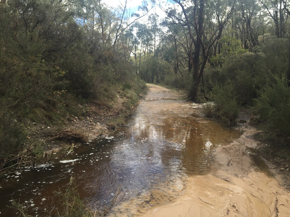
Water across the trails. Photo: Jodie Vidakovic
Features: This circuit is along some of the Yurrebilla Trail, with great views over Adelaide. It is an opportunity to see Cleland Conservation Park from a different perspective and get up close to nature and wildlife.
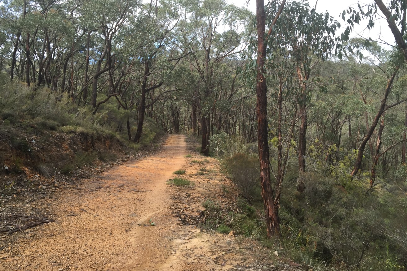
From the Lookout, we took a short decline down towards a T-junction, taking a right onto the Adventure Trail (or Chinamans Hut Track). This is clearly sign-posted along the way and colour-coded orange.
The paths are wide and free from the large groups of people you usually see on the Waterfall Gully Trail. It’s peaceful, with plenty of wildflowers close to the path. Continuing along Chinamans Hut Track, make sure you look up to your left – through the trees you will get a tiny glimpse of Mt Lofty Summit perched atop the hill.
We stayed on this trail until it met the Waterfall Gully Trail, just before the Youth Hostel. Taking a right, we had all but forgotten we still had to climb the steep 500m incline to Mt Lofty Summit. However, we enjoyed the spectacular view across Adelaide before heading back the way we came.
Length: Approximately a 10km loop.
Time: About 2 hours at a moderate pace.
Events: As part of Walktober, Walking SA is running a series of guided walks this weekend – “Trails Less Travelled”. If you want to discover a new trail to Mt Lofty, there are nine different options to choose from. Check out Walking SA’s Facebook page for more details on how to register.
Tip: Download the Avenza PDF Map app so you can access interactive maps when you need them. The app allows you to download National Parks SA maps and uses your device’s built-in GPS to plot your real-time location within the park onto a map. You can also download your Cleland Conservation Park map here, and keep up to date with latest park alerts.
Last week, we hiked the Ambers Gully Track and Sugarloaves Trail.
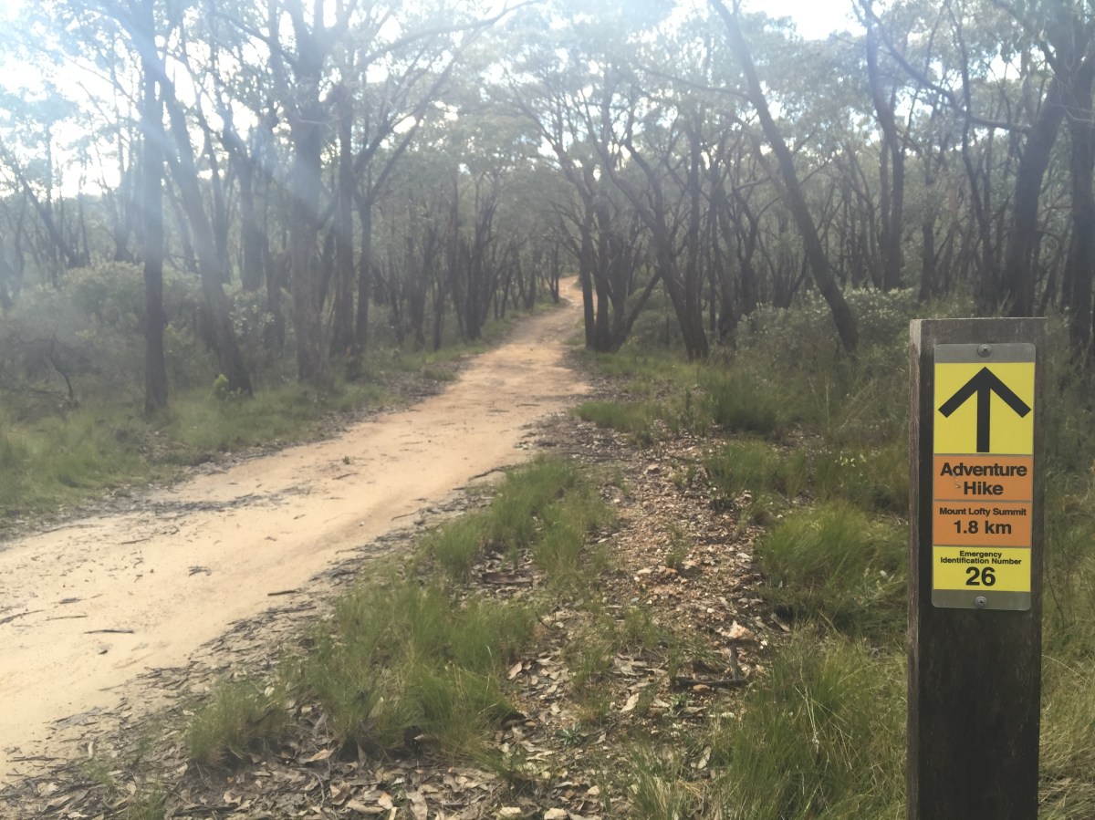
Adventure Hike trail. Photo: Jodie Vidakovic
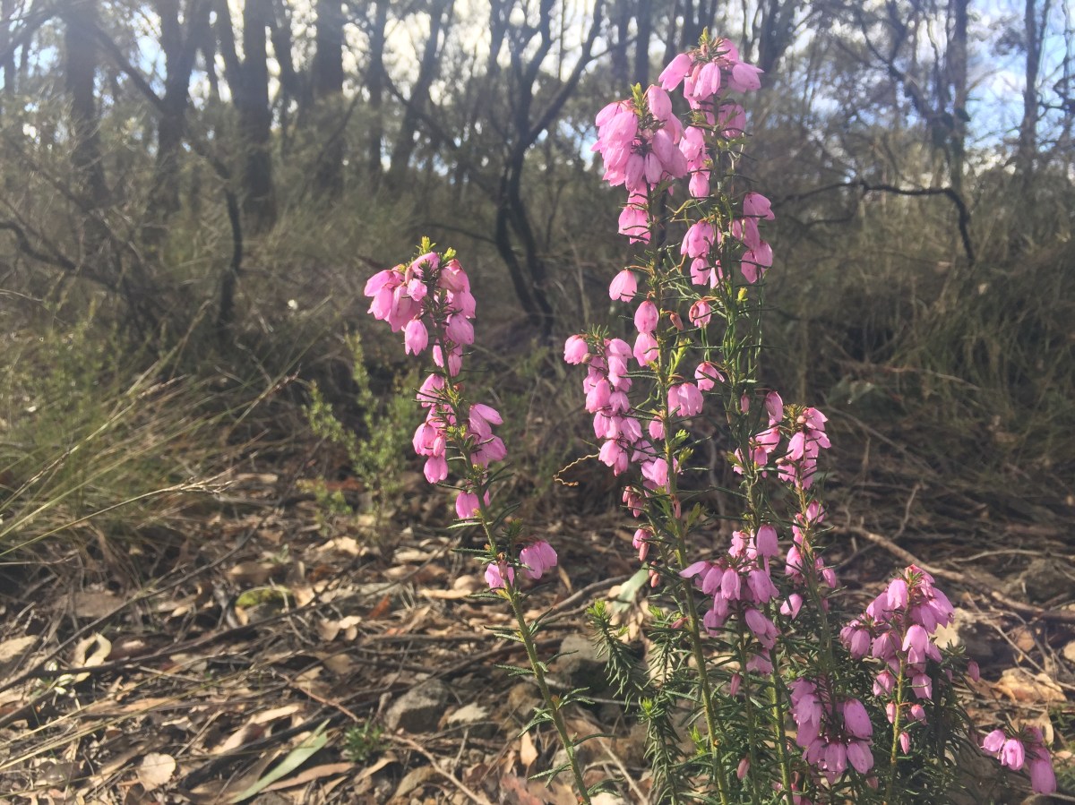
Wildflowers along the way. Photo: Jodie Vidakovic
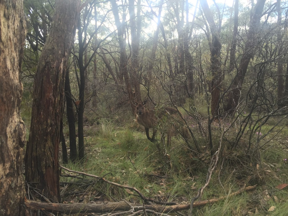
Photo: Jodie Vidakovic
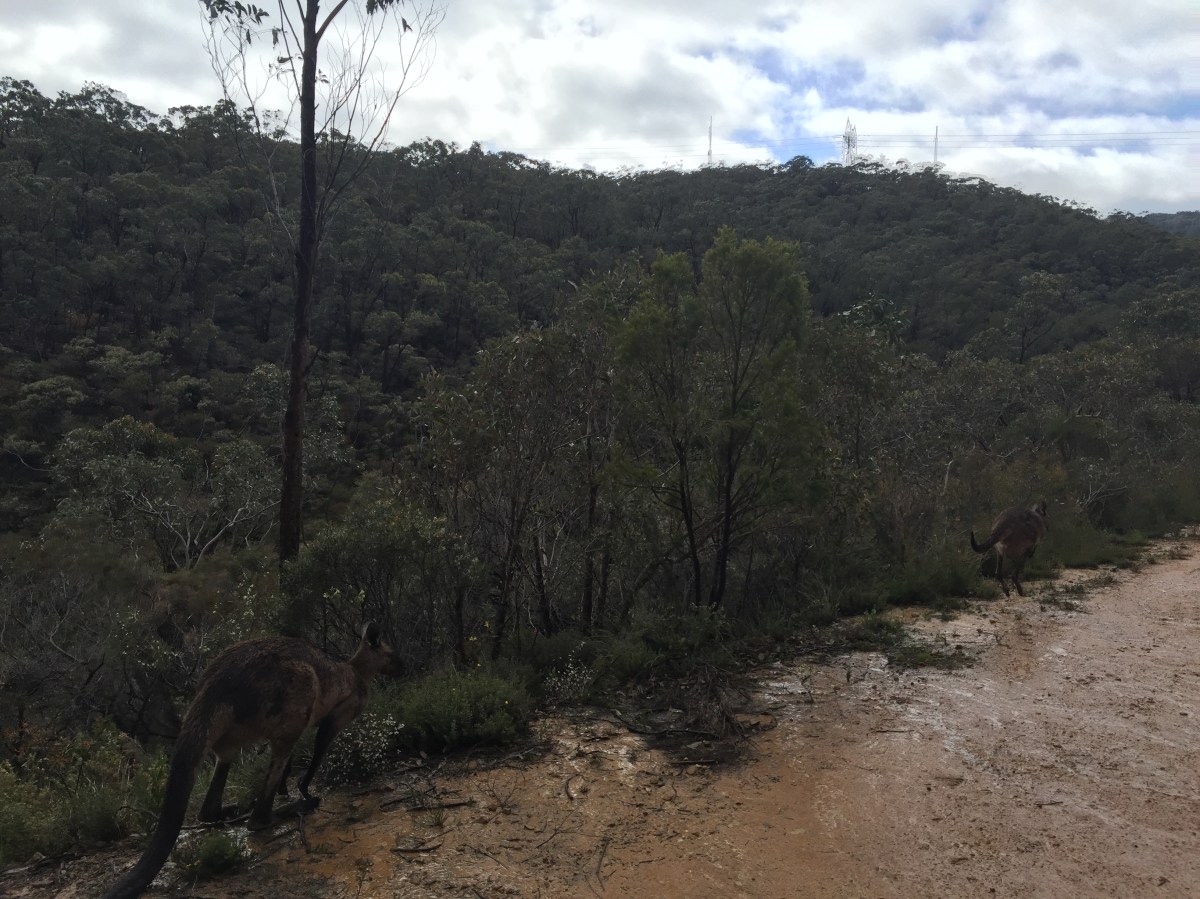
Running with the kangaroos. Photo: Jodie Vidakovic
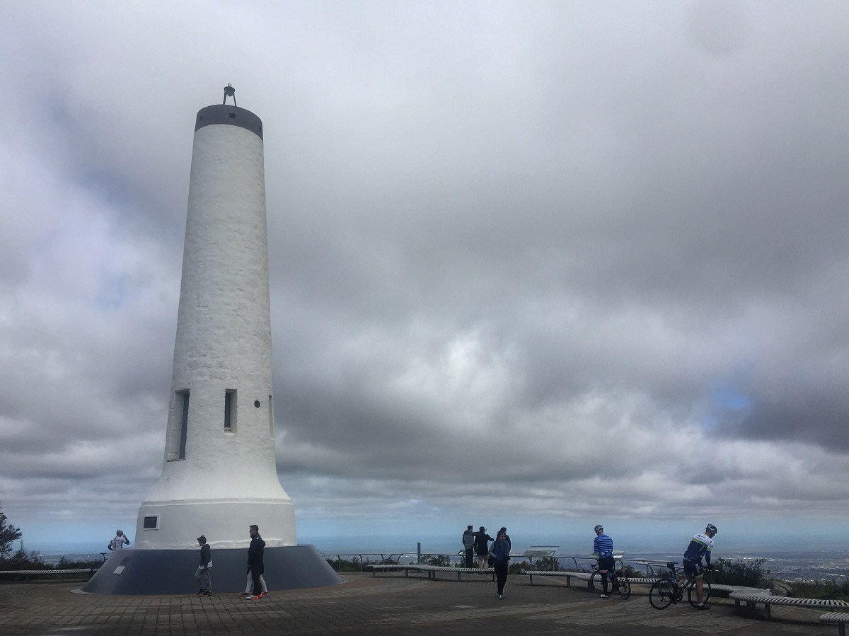
Mt Lofty Summit. Photo: Jodie Vidakovic