Adelaide firm’s 3D makeover for historic French city
Groundbreaking 3D modelling of a French city and its historic chateau is attracting European interest in the South Australian aerial mapping business commissioned for the job.

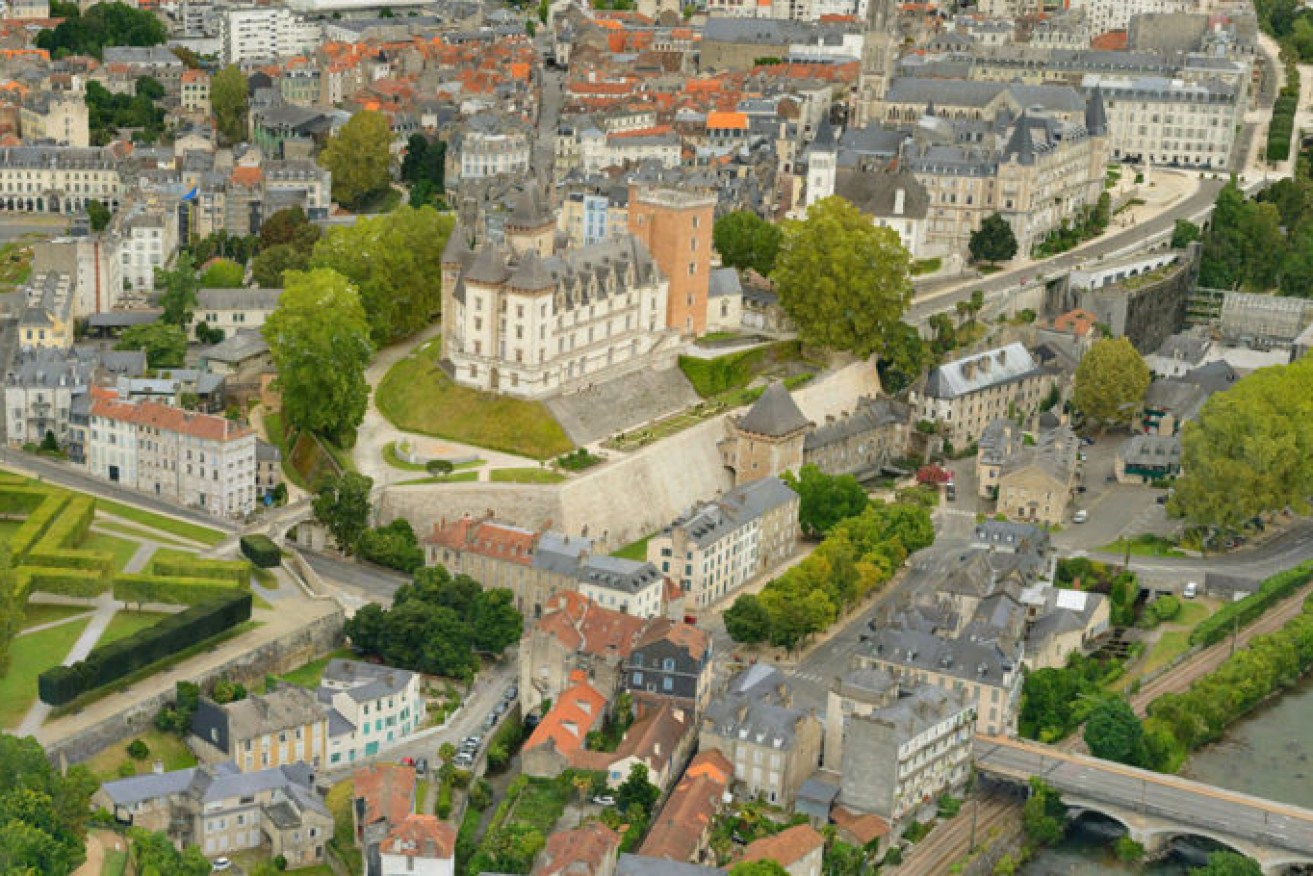
Chateau de Pau. Image: supplied
The city of Pau in southern France launched an international search last year, before choosing Adelaide-based Aerometrex Limited to partner with its local company IGO SAS to complete the work.
The landmark modelling project has now been unveiled for the city known for its art and history – with the model produced at a resolution approaching a few millimetres per pixel.
“This project illustrates the global reach of our 3D modelling service as well as the degree of 3D technical excellence that now exists in the company,” Aerometrex’s managing director Mark Deuter said.
“The 3D model of the city of Pau has set a standard that will attract the attention of every other municipality in Europe.
“We intend to capitalise on this exposure by working closely with our sales channel partners in Europe and the USA in 2020.”
Adelaide-based Aerometrex implemented the science of massive multi-ray photogrammetry for the job, involving the geometric reconstruction of more than 100,000 2D images taken from helicopter, drone and on foot.
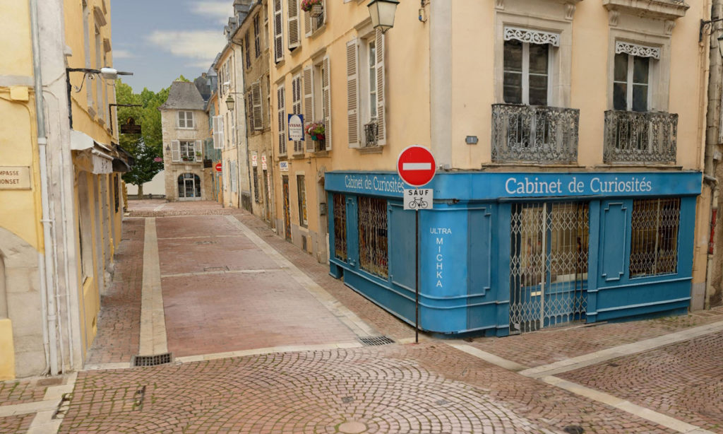
Street view of Pau 3D map. Image: supplied
Now users can get a new visual experience of Pau, the birth city of King Henry IV and one of the regular venues for the Tour de France cycling race.
“The combination of very high-resolution shots and the surface treatment make it a first on a European scale,” Marc Serraf, Director of AEC Informatique, the company in charge of project management assistance, said.
It also now gives planners in the French city the ability to deliver architects or engineers a better understanding of the position of buildings in Pau before construction firms can also deposit digital sketches within the framework of building permits.
The mapping also means stakeholders involved in new building projects can see the concepts from all angles including façade, colours, textures and materials.
Other uses for the mapping include city transport planning, historic building reconstruction work or tourism, where the streets can be walked in virtual space.
Aerometrex was listed on the Australian Securities Exchange (ASX) in December last year with an oversubscribed A$25m initial public offering.
The public listing came after the 30-year-old aerial mapping company saw annual revenue growth rise from $9.7 million to $16.1 million over the past two years.
This latest 3D model project adds another international layer to its growing project portfolio.
The company has also executed international projects in the United States, Africa, the Middle East, Southeast Asia, Papua New Guinea and New Zealand.
Last month the company also announced it had built 3D modelling into its MetroMap subscription service as well as launching its own high-flying camera to capture the images.
Deuter said the ability to process the massive volume of data generated by the three perspectives over a whole city centre into a photo-realistic 3D environment gave users the unparalleled immersive visual experience.
And it was this, he said, that gave Aerometrex a clear lead on the 3D modelling service market worldwide.
The company announced its first half results to the Australian Securities Exchange this morning, reporting revenue growth of 44 per cent on the previous year to $10.1 million.
“This half saw a large increase in revenue growth as the business continues to gain market share in an industry with strong tailwinds,” Deuter said.
“It is particularly pleasing to see the company’s strategic initiatives already starting to deliver positive financial outcomes. With IPO funds received at the end of the reporting period, we are in a strong position to capitalise on the high level of demand for imagery and mapping services across our operating segments.”
Want to comment?
Send us an email, making it clear which story you’re commenting on and including your full name (required for publication) and phone number (only for verification purposes). Please put “Reader views” in the subject.
We’ll publish the best comments in a regular “Reader Views” post. Your comments can be brief, or we can accept up to 350 words, or thereabouts.