Heavy rain, wind lashes Adelaide
A powerful cold front has swept across the state, bringing down trees and causing localised flooding particularly in Adelaide’s northern suburbs.

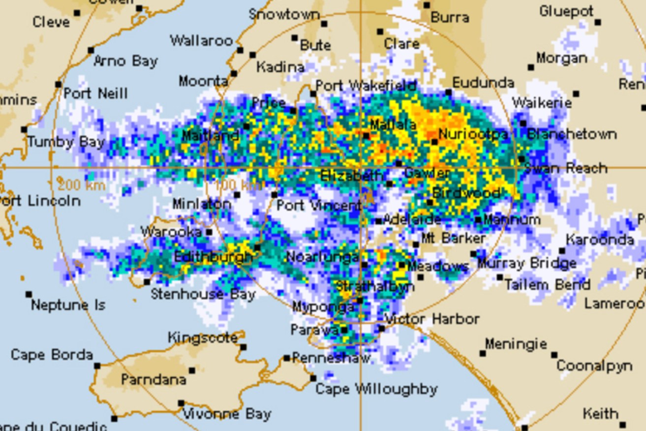
A BOM radar image of Monday morning's storm.
The SES responded to more than 100 incidents as Adelaide recorded more than 33mm of rain overnight – its wettest 24 hours since June 18 last year.
Up to 20mm more rain is expected across Adelaide today as the slow-moving system drifts east.
Northern suburbs motorists are expected to face delays this morning after a large tree fell onto Main North Rd at Salisbury East.
Police said localised flooding was also affecting traffic after a severe storm system came through the northern suburbs.
Large tree has fallen onto Main Nth Rd, S/bury East. Localised flooding is also effecting traffic after a severe storm system came through the nth suburbs. Flooding has occurred Main Nth Rd & Salisbury H/Way & several other suburbs are experiencing flooding. SES/MFS are assisting pic.twitter.com/72KFmactpD
— South Australia Police (@SAPoliceNews) May 29, 2022
Parafield Airport has recorded 60mm, including 15mm between 4am and 5am while Banksia Park and Golden Grove were both doused with more than 30mm in just one hour roughly between 5am and 6am.
The Adelaide Hills received 45mm. Further afield, Nuriootpa recorded 29mm, Strathalbyn 23mm, Edithburgh 39mm, Clare 29mm and Ceduna 31mm.
The SES have made sandbags available for collection today at about 20 of its depots across the state.