Adelaide’s hidden walking trails: Winter Track and Long Ridge Track
The main trail of Cleland Conservation Park leading to Mount Lofty Summit is a challenging one, but did you know there are at least nine other ways to get to the top of the mountain?

Lodge Track to Mt Lofty
For the fifth part of InDaily‘s Adelaide walking trails series, we checked out a different way to get to Mount Lofty.
The walking trails leading to Mount Lofty are some of the state’s most popular and it’s not hard to see why. The extensive network of trails ranges from easy to challenging, rewarding all visitors with amazing views of the area and across the city.
Just over five weeks ago damaging storms left Waterfall Gully inaccessible, leading many Adelaidians to seek out new areas to explore – including me. As part of the ‘Trails Less Travelled’ event by Walking SA, I discovered the Winter Track to Mount Lofty Summit trail.
Trail: Winter Track and Long Ridge Track to Mt Lofty Summit
Access: 10km south-east of the Adelaide CBD; look on your left for Gate 11 about 3km along Waterfall Gully Road. There is on-road parking adjacent to the entrance on your right-hand side.
Rating: Moderate to challenging. Although this is a much slower ascent towards Mt Lofty Summit, it is a much longer trail and you still have to make it up the last 700m of Waterfall Gully Trail to the summit.
Features: Winter Track and Long Ridge Track are mainly wide open fire tracks, making it great for group walks and uninterrupted views of your surrounds. Keep an eye out for kangaroos along the way; koalas were a little more elusive.
We were met by our walking group from Walking SA at Gate 11 at the base of Woolshed Gully and started the walk along Winter Track. It was a nice gentle incline from the beginning, giving you a real opportunity to soak in the surrounds.
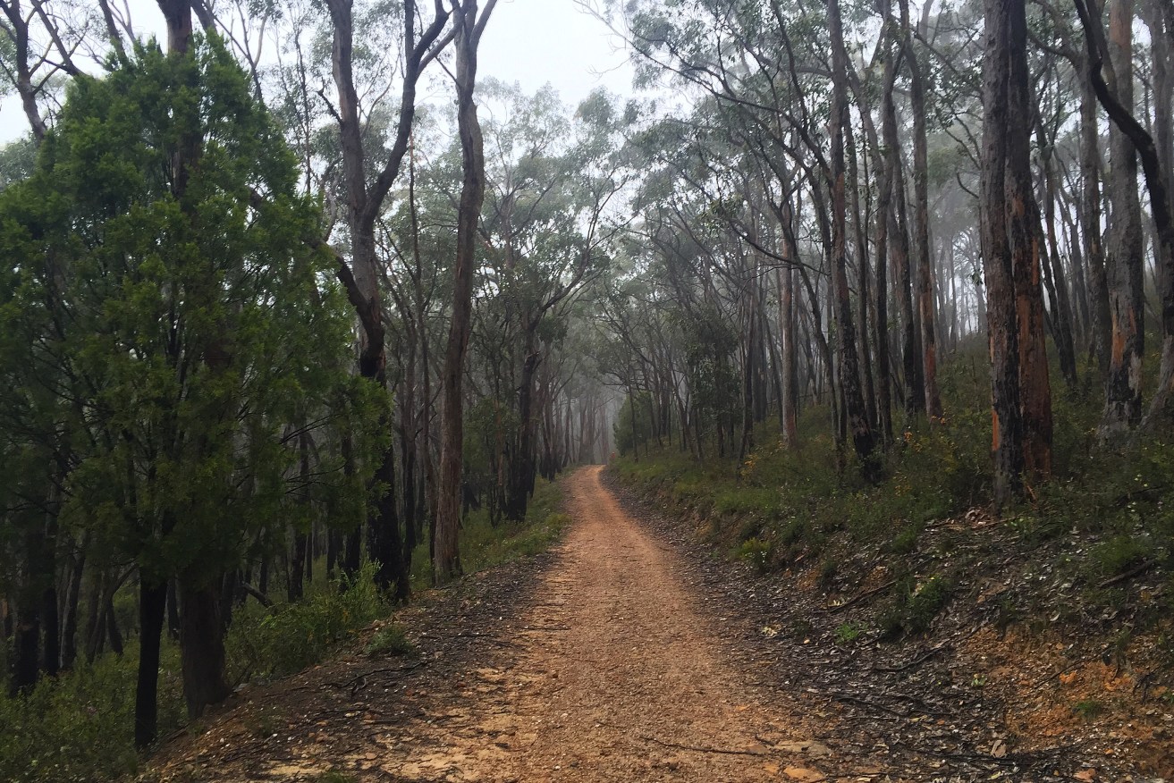
Views from Winter Track. Photo: Jodie Vidakovic
After about 2km of steadily rising track, it takes a sharp left and offers uninterrupted views of the Gully. Continuing on, you will come to a T-junction, meeting with Long Ridge Track (marker 58). You can take a left here if you want to stop by Sugarloaf Lookout. We chose not to, taking a right to begin Long Ridge Track.
This is a wide track, still maintaining a manageable incline. Further along on your right, you will see markers 55 and 54 or the Manna Gum Loop. Through here is the manna gum nursery where branches are harvested for the koalas residing at Cleland Wildlife Park.
Not long after, we were on a bitumen road and able to see Cleland Wildlife Park to the right. Following around the top boundary of the park, we were soon on the Wine Shanty Track. We stayed on the track for a short time, soon after it took a sharp left and then we took a right at the Lodge Track.
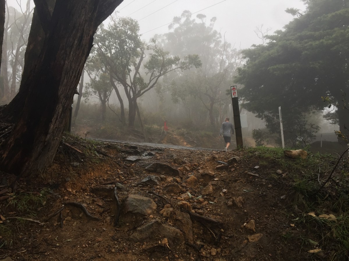
After about 500 metres you will need to cross a road, which then becomes Chinamans Hut Track. Stay on this trail and you will soon meet up with Waterfall Gully Trail, taking a left. Once again we were met with the 700-metre challenge to make it to the top of the mountain. It was easy to forget this is coming.
It was an incredibly wet and windy Sunday morning, so for the first time ever I stopped for a coffee at the top to attempt to get the feeling back in my hands. This may have been a mistake as the rain and wind only increased in that short period of warm bliss.
You can simply take the same way back to the starting point, but curiosity got the better of us and we decided to take the Waterfall Gully Trail back to the car. The theory was it would be a much quicker route and we could check out the damage from the storms.
Parts of the trail were unrecognisable with mud slides to my left and cleared trees to the right. This wasn’t for the whole length of the trail, but the rain, fog, and little to no people around us gave it an atmosphere I had never experienced at Lofty before.
In the last two kilometres of the trail, there were sections bordered by temporary fencing. This only made me feel like the trail wasn’t quite ready for the masses of walkers it would usually see on any given weekend.
Over the coming months, take the opportunity to explore other trails of Adelaide and let Waterfall Gully recover.
Length: Approximately a 13.5km loop.
Time: About 3 to 4 hours at a moderate pace.
Tip: Always familiarise yourself with a map before starting your hike. Download the Avenza PDF Map app so you can access interactive maps when you need them. The app allows you to download National Parks SA maps and uses your device’s built-in GPS to plot your real-time location within the park onto a map. You can also download your Cleland Conservation Park maps here, and keep up to date with latest park alerts.
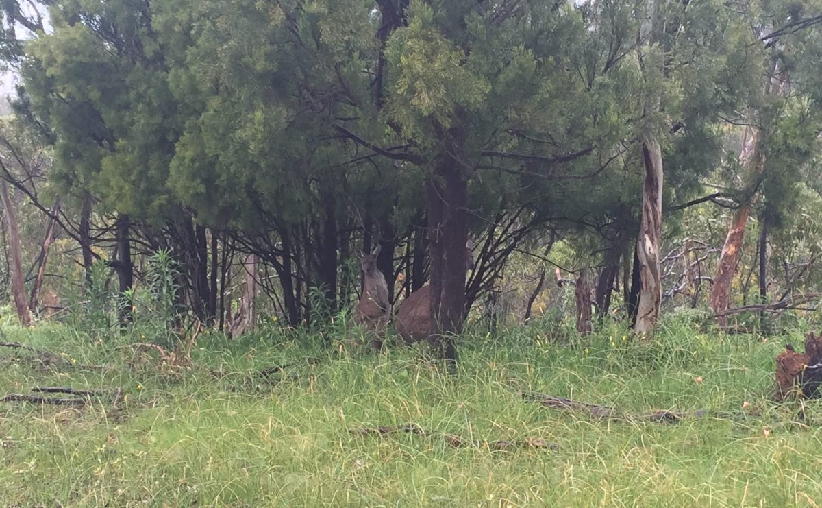
Kangaroo spotting. Photo: Jodie Vidakovic
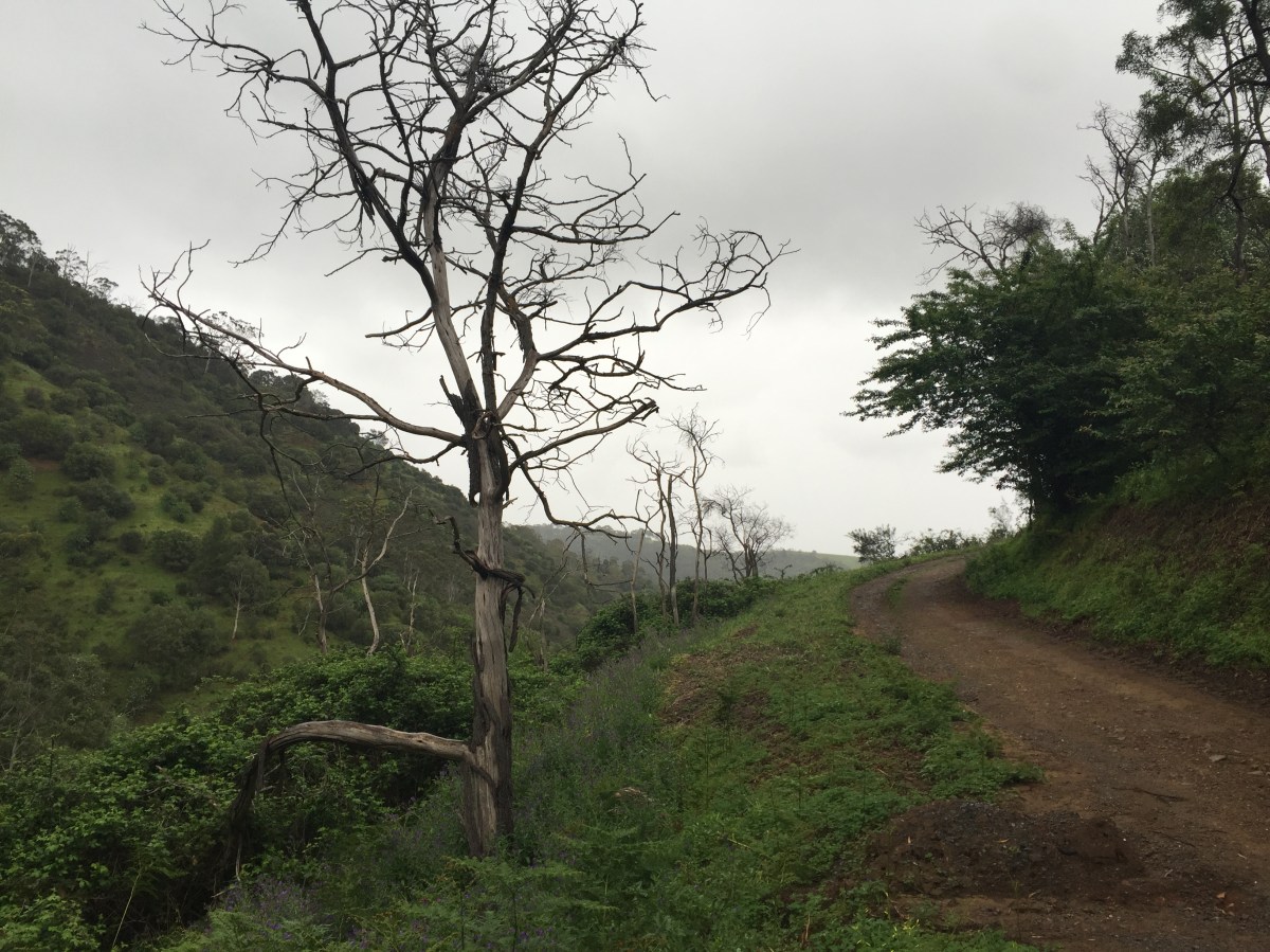
Crossing to Chinamans Hut Track. Photo: Jodie Vidakovic
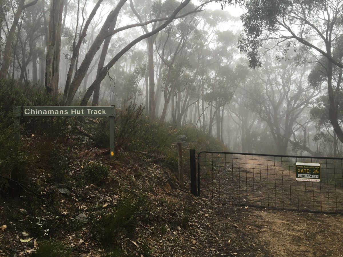
Chinamans Hut Track. Photo: Jodie Vidakovic
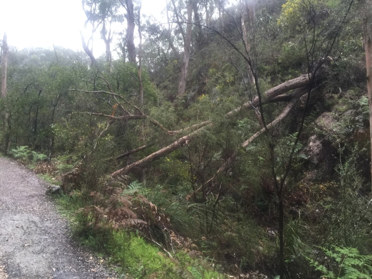
Fallen trees at Waterfall Gully. Photo: Jodie Vidakovic
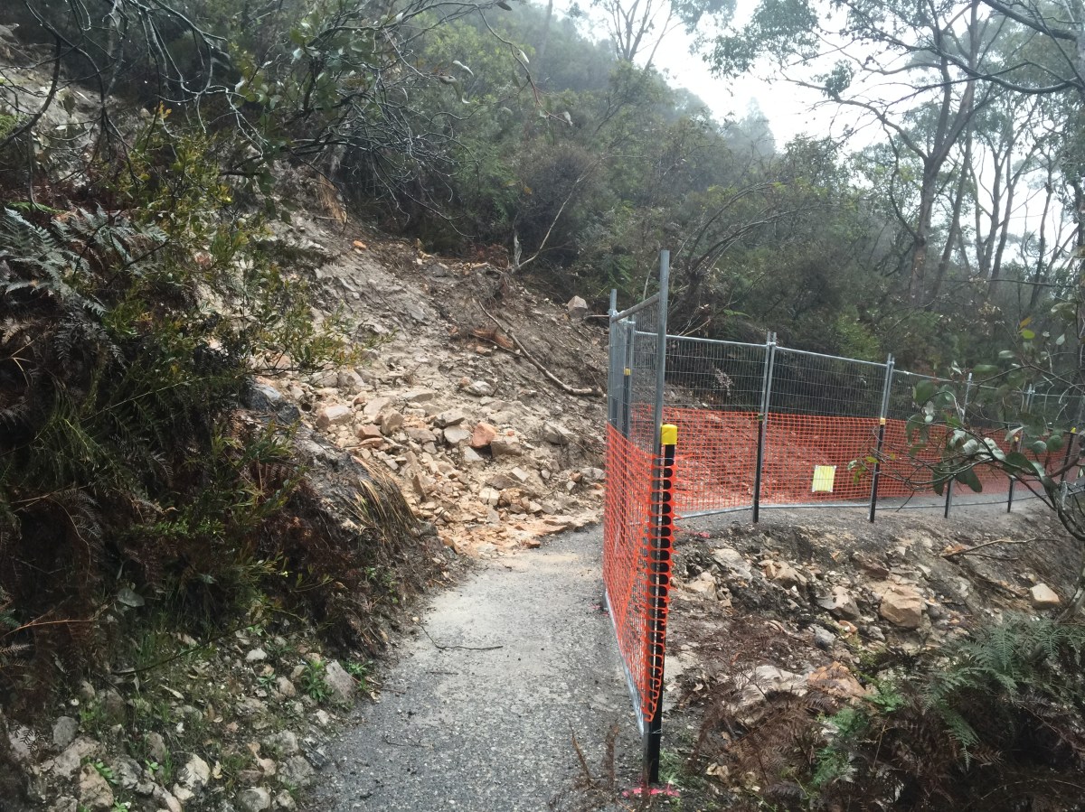
Damaged tracks at Waterfall Gully. Photo Jodie Vidakovic
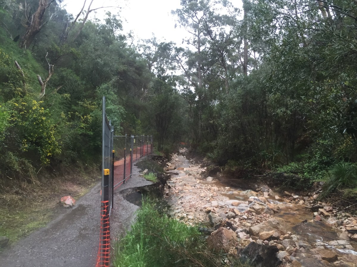
Damaged tracks at Waterfall Gully. Photo Jodie Vidakovic