Adelaide’s hidden walking trails: Horsnell Gully
Horsnell Gully Conservation Park offers varying landscapes with ever-changing views. It may only be a 5km loop, but the steep trail sections and the opportunity to traverse a waterfall make this a challenging walk.

Picturesque trails.
For the fourth part of InDaily‘s series highlighting SA’s lesser-known tracks, we checked out the Main Valley to Rockdale Hill trail.
Horsnell Gully was named after Governor Gawler’s coachman, John Horsnell, who settled there with his family in 1842. Reminders of the family still remain, with ruins scattered throughout the valley. Near the carpark, you will find what remains of two coach houses and a milking shed. I expect it’s mainly locals that visit these beautiful trails as it really is a hidden gem.
Trail: Main Valley and Rockdale Hill Track
Access: 10km east of the Adelaide CBD; carpark located at the end of Horsnells Gully Road. This road leads you to the quarry gate – look for the small park entrance to the right.
Rating: Moderate to challenging. There are steep trail sections as well as the waterfall climb. Take care traversing the waterfall as it is steep with loose rocks, and during wet weather this will be slippery.
Features: Horsnell Gully is made up of narrow walking trails, fire tracks, forested valley trails and steep trail sections. The area is quite beautiful, with diverse and ever-changing scenery as you make your way deeper into the park. Be mindful in the warmer months that there are sections open to the sun.
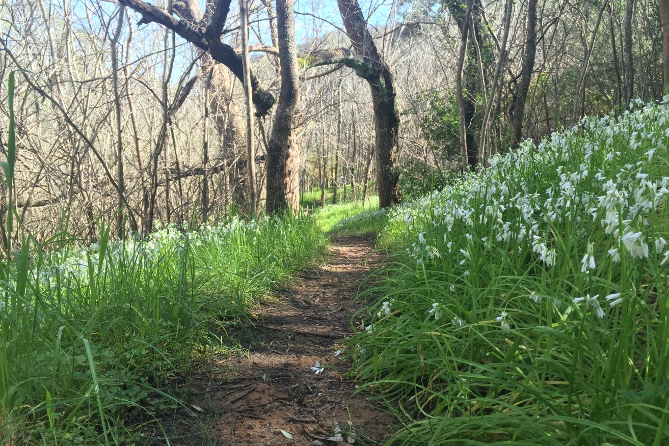
From the carpark, we made our way to the Main Valley trail. This first section of the walk is quite tranquil, taking you beneath red river gums and blue gums. We were quick to question our sense of direction as the paths soon became narrow and looked more like creek beds. I was glad to have my phone with me to check our location, as for the first half of the walk many sections of the trail were not continuous or easily distinguishable. Be assured, if it feels like you are following a creek and up a waterfall, you are going in the right direction.
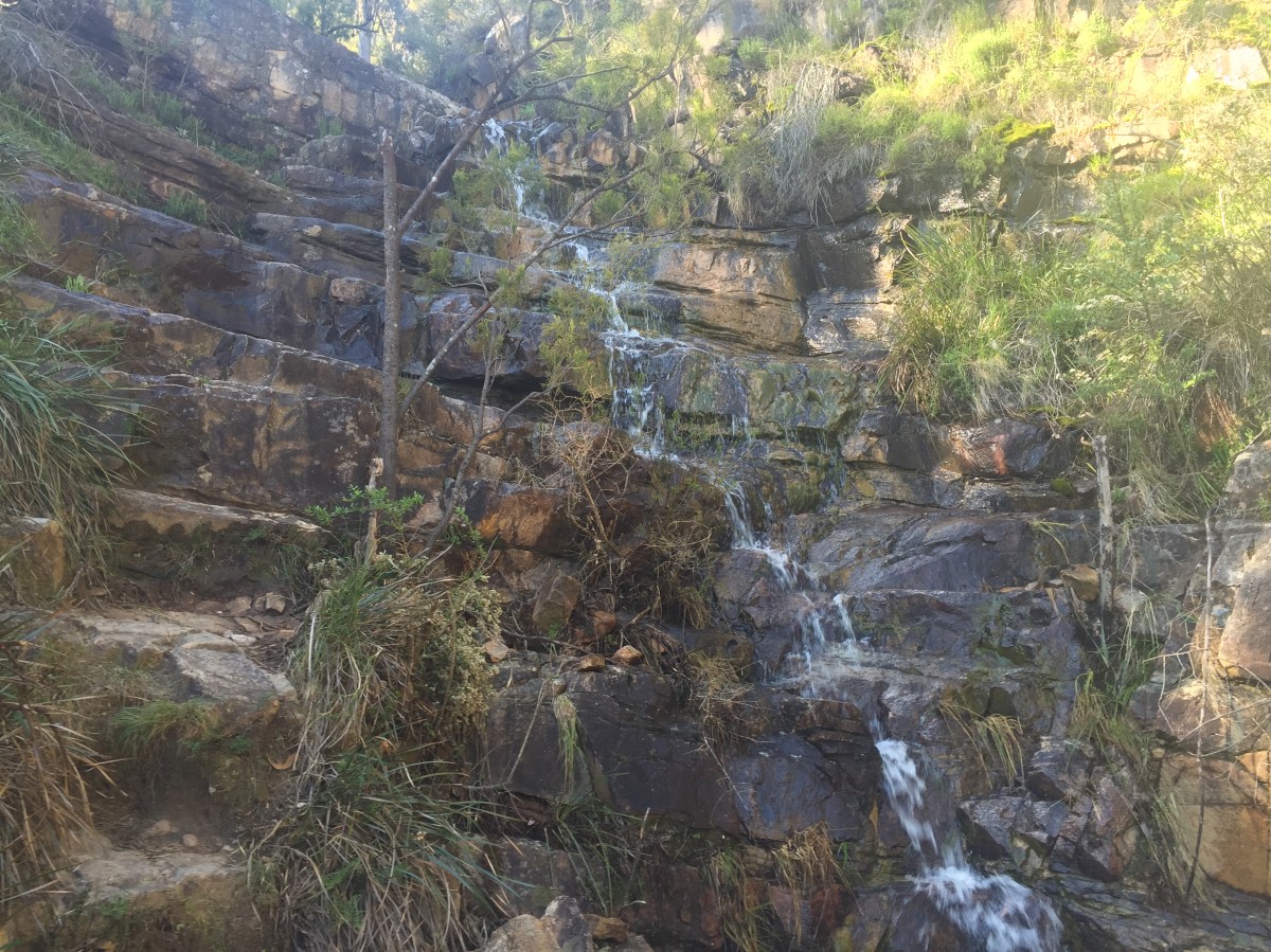
The ‘staircase’ up the waterfall. Photo: Jodie Vidakovic
Soon we approached the foot of the waterfall. It formed a natural staircase to the left, inviting us to make our way to the top (above). I will admit I found this challenging as some of these steps were easily a meter rise, but it made it all the more rewarding when we made it to the top.
Once we made it to the top of the waterfall, and after a quick check of the map to see where we were, we continued easterly on the Main Valley track. This section was quite rocky and loose – take care through here. After a couple hundred metres you will come to the Mount Lofty to Norton Summit Track (Heysen Trail) – take a left here.
Through here the trails widen out to tracks that are much more stable. Take a minute here, catch your breath, and take in the views of Adelaide.
Follow this trail north to Rockdale Hill, taking a left on Rockdale Hill Track. This wide track gradually descends into the scenic valley. Take a left onto the Rockdale Hill Hike. The narrow ridgeline trail gives great views of the nearby quarry. Making your way through the tunnel of overgrown trees, the trail will lead you back to the carpark.
Length: Approximately a 5km loop.
Time: About 1.5 to 2 hours at a moderate pace.
Optional: If you’re looking to extend your hike you can add on Giles Conservation Park. From the top of Rockdale Hill, continue on the Heysen Trail. Along this trail, you will have the opportunity to see the cottage ruins. Depending on how much you want to extend your walk, you can double back at any time following the above trail back to the carpark.
Tip: Always familiarise yourself with a map before starting your hike. Download the Avenza PDF Map app so you can access interactive maps when you need them. The app allows you to download National Parks SA maps and uses your device’s built-in GPS to plot your real-time location within the park onto a map. You can also download your Horsnell Gully Conservation Park maps here, and keep up to date with latest park alerts.
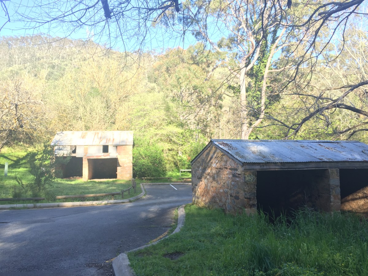
Coach house ruins in the carpark. Photo: Jodie Vidakovic
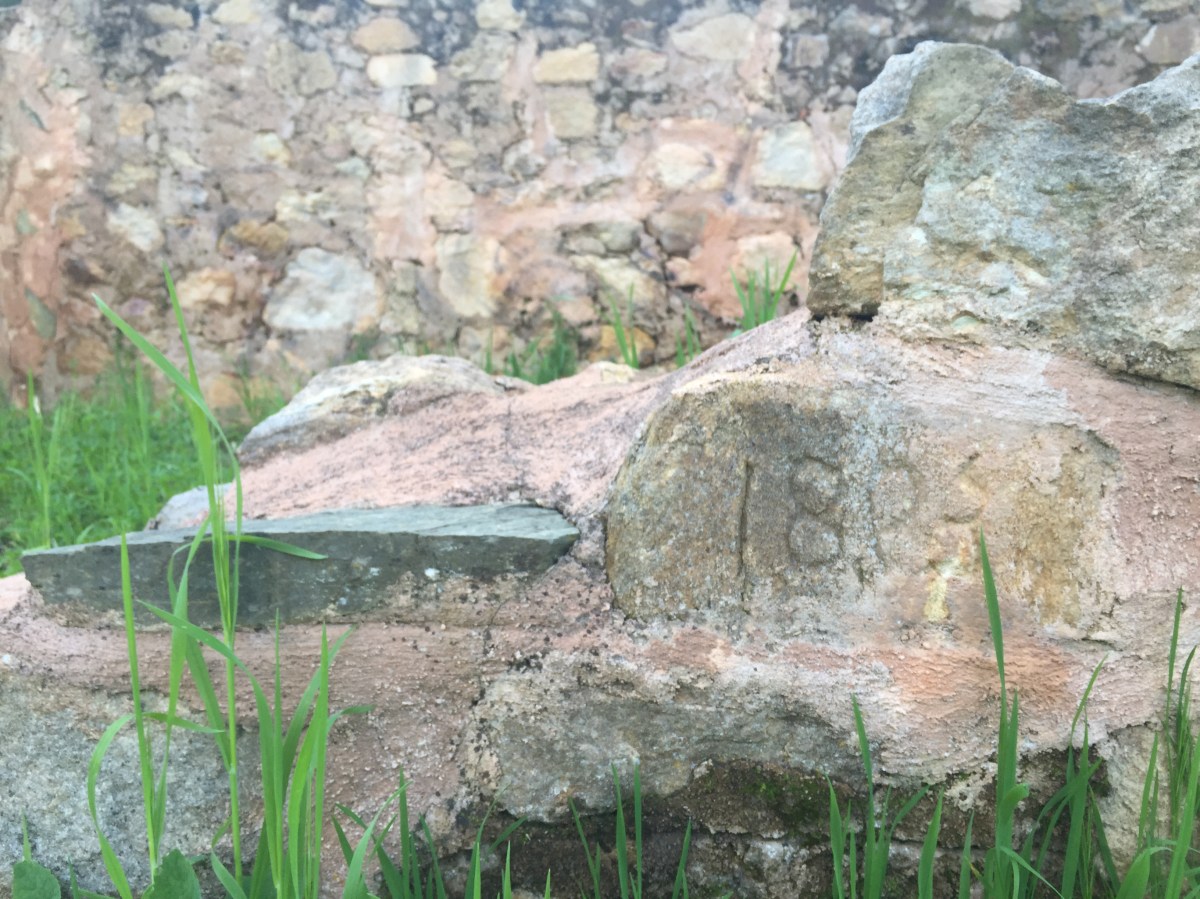
Ruins in the car park. Photo: Jodie Vidakovic
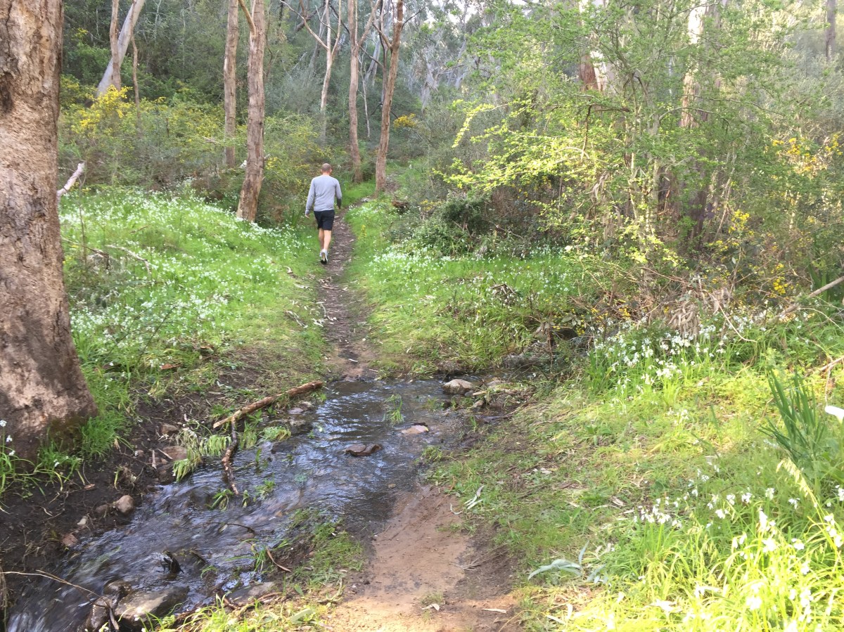
Navigating Main Valley trail. Photo: Jodie Vidakovic
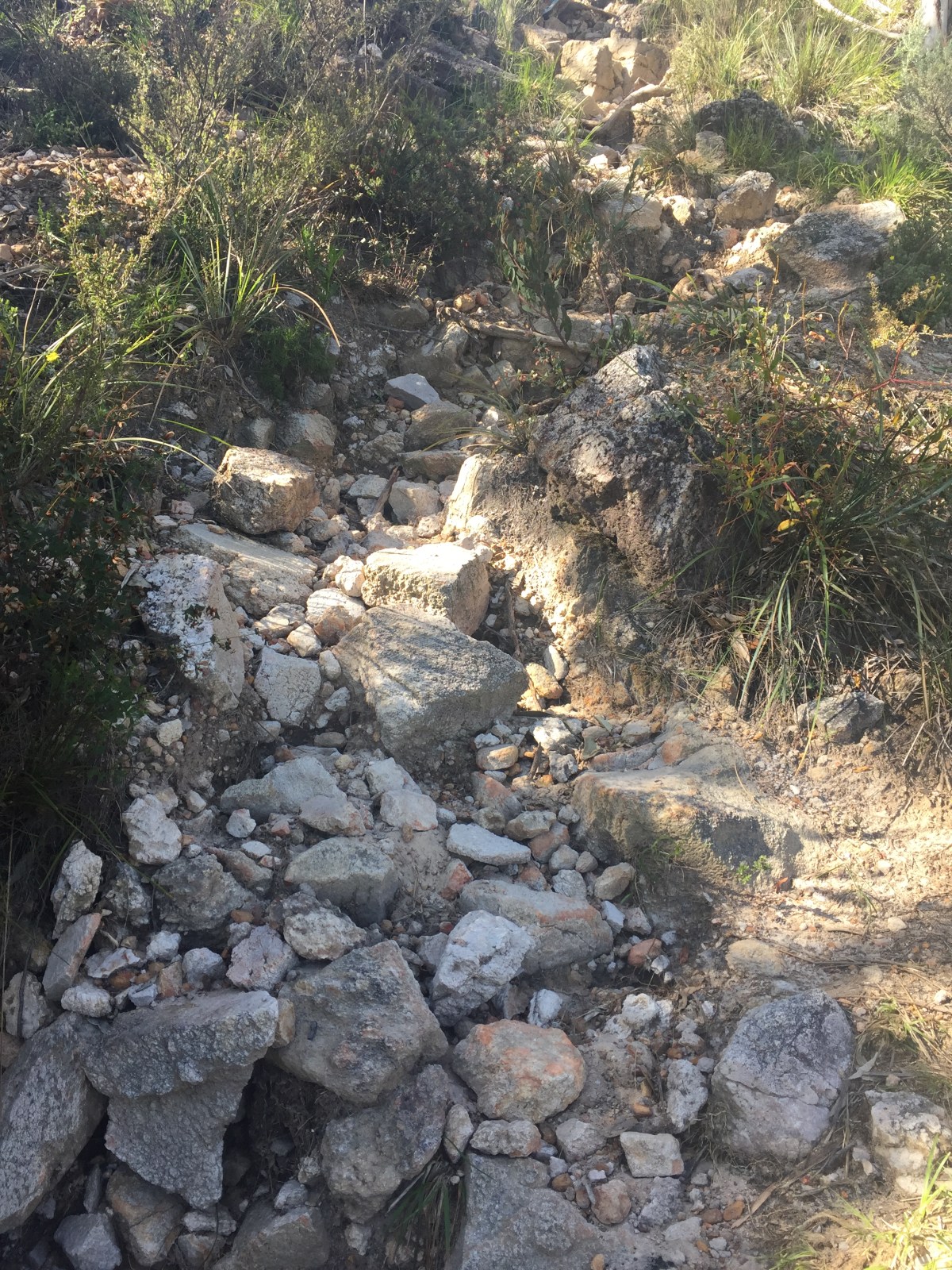
Rocky trail beyond the waterfall. Photo: Jodie Vidakovic
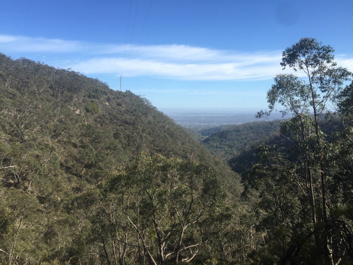
View from the top. Photo: Jodie Vidakovic
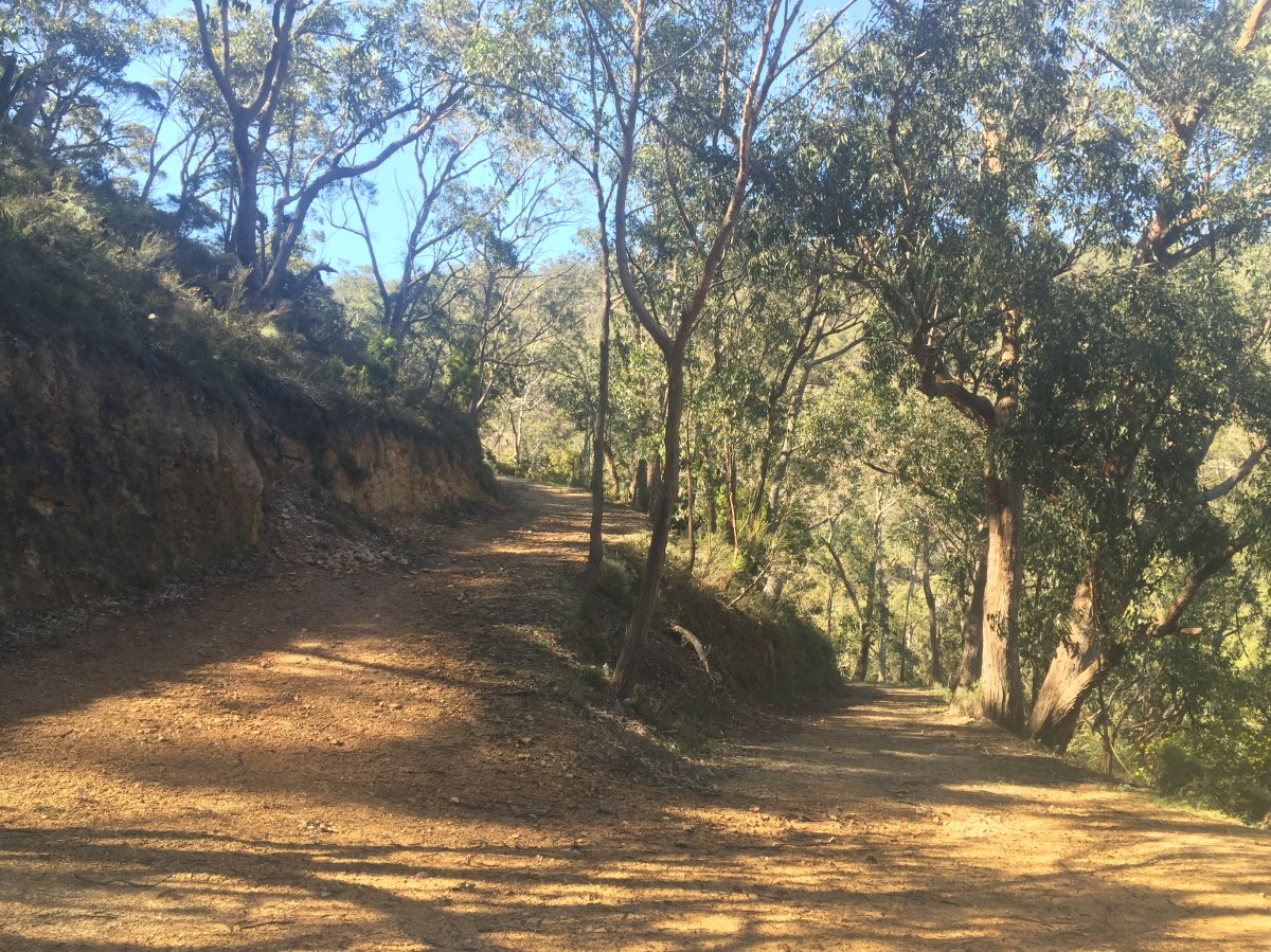
Wider tracks. Photo: Jodie Vidakovic
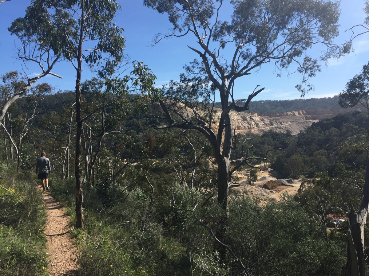
View over the quarry. Photo: Jodie Vidakovic