Levee breach heightens Murraylands flood threat
The State Emergency Service has now issued flood watch and act messages along the entire length of the River Murray in South Australia, with a levee breach in the Murraylands prompting more localised warnings on Sunday.

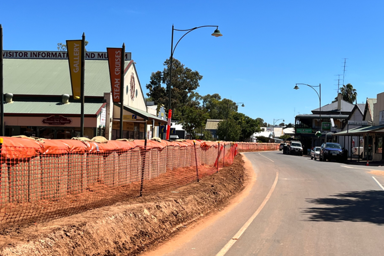
The scene on Randell St in Mannum on Saturday. Photo: Jason Katsaras/InDaily
The SES on Saturday warned residents in low-lying areas of Jervois and Wellington, near Lake Alexandrina at the bottom of the River Murray, to prepare to evacuate, after issuing the same warning on Friday to low-lying residents in Murray Bridge and Tailem Bend.
On Sunday, further flood watch and act messages were issued for the Murraylands towns of Murrawong and Ponde.
The SES said a levee breach near Ponde posed a potential threat to safety.
“This flooding is expected to cause your property to become isolated,” the SES warning read.
“Roads that may be impacted are Weidenhoper Road, Skinner Road, Reserve Parade, Kenny Road and Ponde Landing Road.”
The SES said Murrawong was threatened by another “potential levee breach” which could also isolate properties.
Mid Murray Council mayor Simone Bailey said a tree falling “in the wrong place” was part of the reason for the Ponde levee breach.
“The water which seems to be moving slowly moved quite fast in Ponde yesterday,” she told ABC Radio today.
“The images were quite extraordinary.
“I was talking to a resident … across the river and they said at about 6.35am they heard the crash of a tree falling and they walked outside and got some footage of the levee breaking and water just rushing through.
“I’ve spoken to a couple of families on that side of the river at Ponde, they managed to obviously work together as you do in beautiful resilient communities and get all of the animals and property off of the land.”
Bailey said she was not aware of any other concerns about levees around the Murraylands.
Meanwhile, on the Mannum riverfront, houseboat owners spent much of the weekend securing their vessels before waters are forecast to rise significantly this week.
On Saturday, Mannum houseboat owner Charlie said he was concerned his houseboat will drift away in the upcoming peak.
“I came down here to tie it up, I’ve had to hitch it to a few posts I’ve put in the ground,” he said.
Charlie said he was told by a friend to consider docking his boat in a nearby marina, but on inspection the marina was completely submerged.
“When I got there the whole place was underwater – it’s not much use if there’s nothing to secure anything to,” he said
“My neighbours have a CCTV camera which I’ll be able to watch the boat on, it’s solar powered which is good because all the power’s been shut off.
“Overnight all the riverfront grass has just completely gone underwater.”
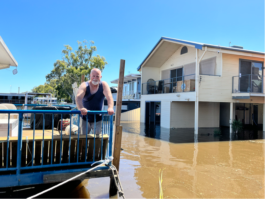
Charlie on his houseboast in Mannum on Saturday. Photo: Jason Katsaras/InDaily
The state government is from today offering free financial counselling services at emergency relief centres in Berri (Monday to Friday) and Mannum (Wednesday to Friday) to help flood-affected residents.
The government also says it has fast-tracked 230 cost-of-living concessions for residents in River Murray communities.
The flooding threat from the swollen River Murray is gradually moving downstream from the Riverland, with authorities predicting the flood peak will hit Berri between December 25 and January 5, Waikerie between January 1-12, Swan Reach between January 5-16 and Murray Bridge between January 6-17.
The peak flow predictions remain between 190 and 220-gigalitres a day, predicted to hit Renmark between December 24-31.