SES deputy warns SA storms and floods are climate change in action
South Australians are now living in climate change as wild storms wreak havoc across the state and the River Murray floods, according to the State Emergency Services deputy chief.

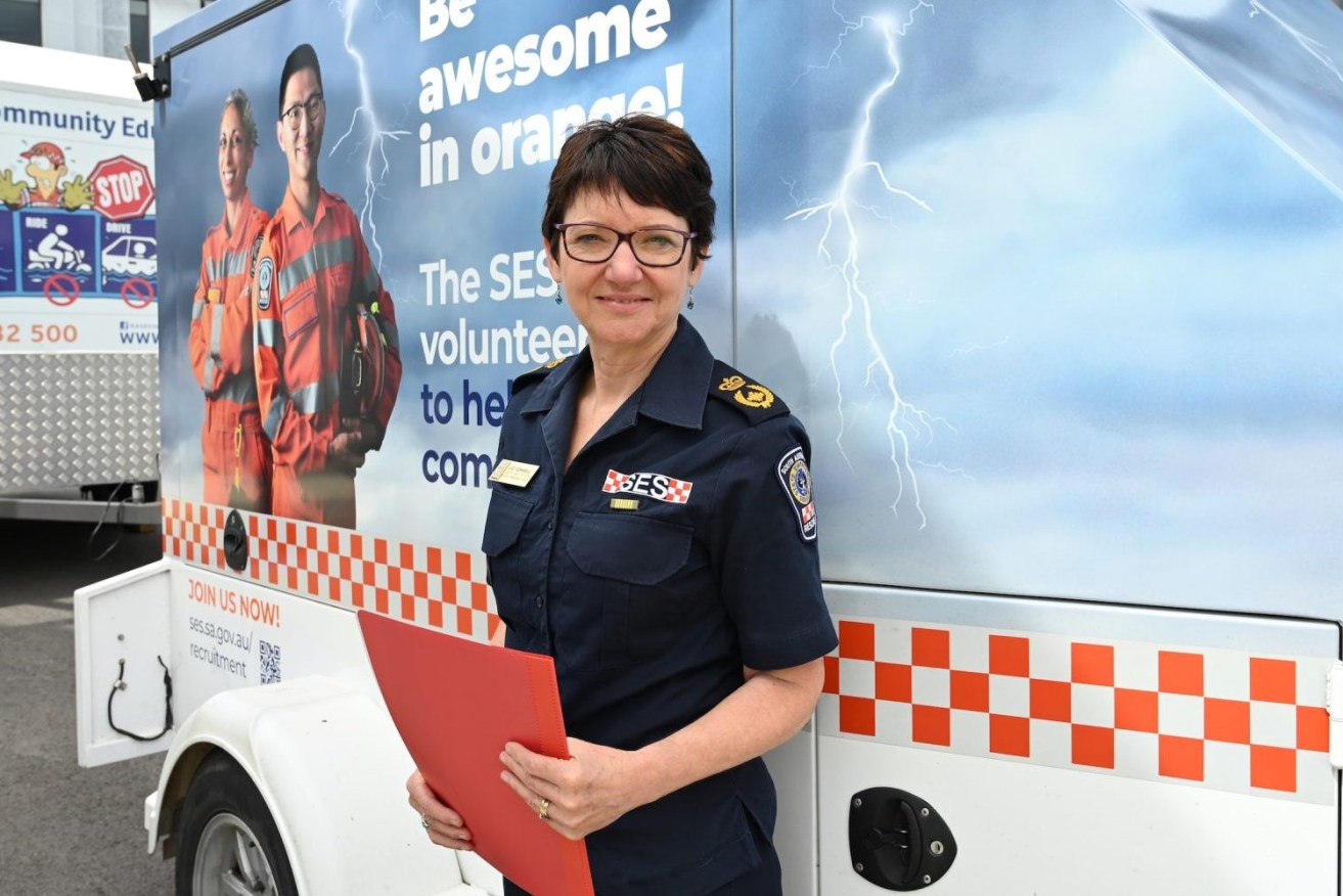
SES deputy chief officer Liz Connell. Photo: Belinda Willis/InDaily
Liz Connell said the community needs to prepare for ongoing events like intense storms sweeping through the state on “an almost weekly basis” through three years of a highly unusual La Nina weather pattern.
“I’ve worked in the climate change space for a long time and we have talked about the greater intensity and the greater frequency of events – we’re living that now,” Connell said from SES headquarters in Keswick.
“My sense is that we just need to deal with that as our reality and support the community to understand that that’s how it is because, obviously, they become very exhausted by that as well.
“If you look over the border, some of those New South Wales communities have been hit multiple times, five times in 12 to 18 months, where they have experienced flooding and their ability to recover from that is quite challenged.”
Some 600 of South Australia’s 1700 state emergency volunteers have been over the border helping flooded communities in what has been a tumultuous year for Connell, who was appointed in October last year as the first woman to take on the deputy chief officer role in the state’s SES.
The year started with intense rainfall causing severe flooding in the state’s north during January, with the SES working to fix damage threatening food and vital supplies as major transport rail and road routes were closed.
SES deputy chief officer Liz Connell. Photo: Belinda Willis/InDaily
In February, continual SES deployments began to assist New South Wales with flooding through to June, then in early October, the SES began flood planning for River Murray regions in South Australia as the first high flow predictions were flagged.
Since then, the SES’s volunteers and 68 staff have established an incident management team in the Riverland town of Loxton, distributed sandbags, and helped assess and build levees to protect properties and vital infrastructure.
They have been integral to providing continual community updates and supporting meetings throughout the river regions to plan for flooding impacts on homes and businesses.
Connell’s belief that communities are now living with climate change were backed by a joint CSIRO and Bureau of Meteorology biennial State of the Climate Report released this week. It showed that the nation is now experiencing intense heavy rainfall and extreme heat events at a greater pace.
The report warned that intense short rainfall events will increase along with the length of bushfire risks.
The Bureau of Meteorology’s manager of climate environmental prediction services, Dr Karl Braganza, said La Niña events in 2021-22 led to eastern Australia experiencing one of its most significant flood periods ever observed.
This week, the State Government declared a state emergency as predicted River Murray flows were increased to 175GL a day in December with warnings the figure could go higher.
Premier Peter Malinauskas said there would likely now be two high peaks that last longer than the original forecast, as rainfall across the border and releases from the Hume Dam continue to push up predictions.
“I think our greatest challenge is going to be around the duration of the event, sustaining our effort for that period of time,” Connell said.
“We have already been working on this for a couple of months and we have got at least through January, perhaps through to February, to go.”
In the meantime, recent storms in South Australia have swept across the state taking down power lines, trees, damaging buildings and causing flooding.
Storms with heavy rain and lightning strikes in Adelaide two weeks ago resulted in demand comparable to 2016’s wild weather, with the SES receiving about 3000 calls for assistance over a weekend where about 35,000 people lost power.
Another storm hit the state causing damage over the past weekend with power outages across Adelaide from Two Wells in the north to O’Halloran Hill in the south, as well as in the Riverland.
The coming bushfire season is assessed as posing an average risk but there will be an increased load of vegetation. During bushfires, the SES supports the CFS and MFS through incident management teams.
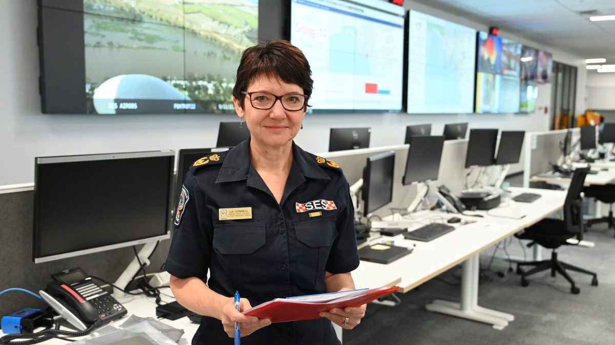
The SES moved into a purpose-built headquarters at Keswick in December last year. The site co-locates the Country Fire Service and Metropolitan Fire Service for the first time, making it easier to share vital services and intel.
State-of-the-art dashboard screens show ongoing incidents and observations; one focused on the River Murray displays 599 air observations taken from fixed-wing planes, helicopters and drones.
“It has been a huge, few weeks, but we really have been viewing this event as a marathon; we are pacing ourselves, this is going to go on for a couple of months,” Connell said of the River Murray data.
“That is a key message to our staff and volunteers, that we need to be well and truly prepared for the duration of the event.”